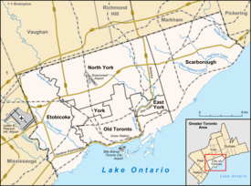
Junction Triangle
| Junction Triangle | |
|---|---|
| Neighbourhood | |
 Neighbourhood map |
|
| Location within Toronto | |
| Coordinates: 43°39′32″N 79°26′46″W / 43.659°N 79.446°WCoordinates: 43°39′32″N 79°26′46″W / 43.659°N 79.446°W | |
| Country |
|
| Province |
|
| City |
|
| Government | |
| • MP | Andrew Cash (Davenport) |
| • MPP | Cristina Martins (Davenport) |
| • Councillor | Ana Bailão (Ward 18 Davenport) |
Junction Triangle is a neighbourhood in Toronto, Ontario, Canada. It is located in the city's west end, just west of Lansdowne Avenue. The area is a triangle surrounded on all three sides by railway lines. The CNR/CPR mainline to the west, Metrolinx GO Transit Barrie line to the east, and the CPR east-west railway lines to the north. Bloor Street cuts across the middle of the neighbourhood, Dupont Street runs close to the northern edge, and Dundas Street close to the southern boundary. By some accounts, the recent residential developments of Davenport Village and Foundry Lofts, built on former factory lands north of CP Rail line, west of Lansdowne, south of Davenport and east of GO Transit Bradford/Newmarket/Barrie line, also belong in this neighbourhood.
For a long time there was no agreed upon name for the area, generically referred to as West Toronto, others considered parts Bloordale, north of Dupont west of present-day Campbell had old factories considered within boundaries of The Junction and West Toronto Junction, yet other parts of area remained officially unnamed.
In 2009, an effort was launched by locals in the community to find a name. Junction Triangle had been used by the city for the area since the 1970s. For demographics purposes the area is part of the Dovercourt-Wallace-Emerson-Junction district. A local residents association was called the South Junction Triangle Residents Association. One issue is that it is based on the nearby and much better known neighbourhood The Junction, and leads to frequent confusion. The area was also never part of the historic town of West Toronto Junction, but was called Town of West Toronto, before annex.
The Fuzzy Boundaries project was created to try to find a new name. A vote was held in March 2010. Some 230 options were submitted originally, and after a narrowing process the vote was between ten options. The final vote was:
...
Wikipedia

