Jasonville, Indiana
| Jasonville, Indiana | |
|---|---|
| City | |

Main Street in Jasonville
|
|
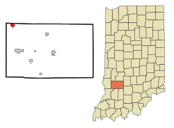
 Location in the state of Indiana |
|
| Coordinates: 39°9′41″N 87°12′4″W / 39.16139°N 87.20111°WCoordinates: 39°9′41″N 87°12′4″W / 39.16139°N 87.20111°W | |
| Country | United States |
| State | Indiana |
| County | Greene |
| Government | |
| • Mayor | Roy L. Terrell, Sr. (D) |
| Area | |
| • Total | 1.31 sq mi (3.39 km2) |
| • Land | 1.31 sq mi (3.39 km2) |
| • Water | 0 sq mi (0 km2) |
| Elevation | 633 ft (193 m) |
| Population (2010) | |
| • Total | 2,222 |
| • Estimate (2012) | 2,204 |
| • Density | 1,696.2/sq mi (654.9/km2) |
| Time zone | EST (UTC-5) |
| • Summer (DST) | EDT (UTC-4) |
| ZIP code | 47438 |
| Area code(s) | 812 |
| FIPS code | 18-37764 |
| GNIS feature ID | 0436943 |
Jasonville is a city in Greene County, Indiana, United States. The population was 2,222 as of the 2010 census. It is the westernmost community in the Bloomington, Indiana, Metropolitan Statistical Area, approximately 15 miles closer to Terre Haute than to Bloomington.
Jasonville was founded in 1858. It was named for one of its founders, Jason Rogers.
Jasonville, Indiana is rich in history including a big fire in 1914, a booming mining community of the past, and the establishment of Shakamak State Park. The Jasonville motto is "Gateway to Shakamak" as Shakamak State Park is only 3 miles from the town.
Jasonville is located at 39°9′41″N 87°12′4″W / 39.16139°N 87.20111°W (39.161511, -87.201027).
According to the 2010 census, Jasonville has a total area of 1.31 square miles (3.39 km2), all land.
As of the census of 2010, there were 2,222 people, 882 households, and 568 families residing in the city. The population density was 1,696.2 inhabitants per square mile (654.9/km2). There were 1,022 housing units at an average density of 780.2 per square mile (301.2/km2). The racial makeup of the city was 98.1% White, 0.2% African American, 0.1% Native American, 0.4% Asian, 0.4% from other races, and 0.9% from two or more races. Hispanic or Latino of any race were 0.8% of the population.
...
Wikipedia
