Isla Martín García
| Isla Martín García | |
|---|---|

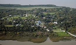
Aerial photograph of Martín García Island from the west, with airstrip visible in background
|
|
| Diagram of Martín García and Timoteo Domínguez Islands, before they were physically united in one land mass. | |
| Geography | |
| Location | Río de la Plata |
| Coordinates | 34°10.79′S 58°15′W / 34.17983°S 58.250°WCoordinates: 34°10.79′S 58°15′W / 34.17983°S 58.250°W |
| Area | 1.84 km2 (0.71 sq mi) |
| Highest elevation | 27 m (89 ft) |
| Administration | |
| Province | Buenos Aires |
| Partido | La Plata |
| Demographics | |
| Population | 150 (2008) |
Martín García Island (Spanish: Isla Martín García) is an island in the Río de la Plata. The island is in Uruguayan waters but in 1973 Uruguay and Argentina reached an agreement establishing Martín García as Argentine territory and a nature reserve. The island of 1.84 km2 (0.71 sq mi) has a permanent population of about 150 people (50 families), and falls within the jurisdiction of Buenos Aires Province. The island is accessible by air through Martín García Island Airport.
The strategically located island was the site of a fortification built in the 1820s by Argentine forces to deny the Brazilian navy access to the Uruguay River. This fort, named Constitucion, succeeded in keeping Brazilian reinforcements at bay during the Battle of Juncal between 8 and 9 February 1827, allowing the Argentines to destroy the Brazilian squadron operating on the Uruguay River during the Cisplatine War.
In more recent times, several Argentine political figures have been held under arrest at the island by military governments, including presidents Hipólito Yrigoyen (1930), Juan Perón (1945), and Arturo Frondizi (1962).
Martin Garcia Island was discovered by the Spanish in the expedition of Juan Díaz de Solís in 1516; it is named after the storekeeper Martín Garcia, who died on board and whose body was buried on the island. From that time, the island was continually disputed by Spain and Portugal due to its strategic position amidst the main river channel and as a gateway to its main tributaries, the Paraná and Uruguay rivers.
The island was used as a penal colony from 1765 until 1886. Developed by the Viceroyalty of the Río de la Plata, the first viceroy Pedro de Cevallos fortified the island and assigned a military garrison there. In 1814, Admiral William Brown, commanding a fleet, landed on the island and defeated the royalists, leaving Martin Garcia in the hands of the United Provinces of Río de la Plata.
...
Wikipedia

