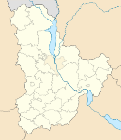
Irpin Municipality
|
Irpin Ірпiнь Ирпе́hнь |
|||
|---|---|---|---|

Irpin town hall
|
|||
|
|||
| Coordinates: 50°31′00″N 30°15′00″E / 50.51667°N 30.25000°ECoordinates: 50°31′00″N 30°15′00″E / 50.51667°N 30.25000°E | |||
| Country |
|
||
| Oblast |
|
||
| Municipality | Irpin city | ||
| Founded | 1899 | ||
| City rights | 1956 | ||
| Area | |||
| • City | 110.83 km2 (42.79 sq mi) | ||
| Population (2013) | |||
| • City | 42,924 | ||
| • Density | 360.460/km2 (933.59/sq mi) | ||
| • Metro | 100,3901 | ||
| Time zone | EET (UTC+2) | ||
| • Summer (DST) | EEST (UTC+3) | ||
| Postal code | 08200 — 08279 | ||
| Area code(s) | +380 4597 | ||
| Website | Official website | ||
| 1 The metro population for Irpin are the statistics for the whole Irpin City Rada. | |||
Irpin (Ukrainian: Ірпі́нь), or Irpen (Russian: Ирпе́нь) is a city located on the Irpin River in Kiev Oblast (province) right next to Kiev city in northern Ukraine. Portion of Irpin Municipality is located within the city of Kiev.
Administratively, it is incorporated as a city of oblast significance and serves as an administrative center of Irpin Municipality, which includes the city of Irpin and three urban-type settlements. Population: 42,924 (2013 est.).
The city has a railway station, built in 1899. From 2003, the "Irpen Film Festival" for alternative cinematography takes place every year.
Since the 17th century on territory of Irpin, there was a village of Romanivka and khutir Lyubka. In the 19th century there appeared Severynivka village and khutirs Rudnya and Stoyanka.
Irpin was formed in 1899 as a passing loop, during construction of the Kiev—Kovel railway line. Railway workers founded the town near the railway road along with other localities such as Bucha and Vorzel. The city's name (along with the city of Vorzel) was chosen due to its location on the Irpin River.
From July 26, 1941, right after the Battle of Kiev, it was occupied by the Wehrmacht until early February 1944. Most of its Jewish population was killed in either Babi Yar or other massacres.
...
Wikipedia


