Indian Springs, Nevada
| Indian Springs, Nevada | |
|---|---|
| Unincorporated town | |
 |
|
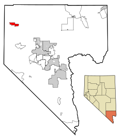
 Location of Indian Springs in Clark County, Nevada |
|
| Location in the United States | |
| Coordinates: 36°34′18″N 115°40′38″W / 36.57167°N 115.67722°WCoordinates: 36°34′18″N 115°40′38″W / 36.57167°N 115.67722°W | |
| Country | United States |
| State | Nevada |
| County | Clark |
| Area | |
| • Total | 18.0 sq mi (46.6 km2) |
| • Land | 18.0 sq mi (46.6 km2) |
| • Water | 0.0 sq mi (0.0 km2) |
| Elevation | 3,169 ft (966 m) |
| Population (2010) | |
| • Total | 991 |
| • Density | 55/sq mi (21/km2) |
| Time zone | PST (UTC-8) |
| • Summer (DST) | PDT (UTC-7) |
| ZIP code | 89018 |
| Area code(s) | 702 |
| FIPS code | 32-35300 |
| GNIS feature ID | 0847373 |
| Website | Indian Springs Town Advisory Board |
Indian Springs is an unincorporated town and a census-designated place near Creech Air Force Base in northwestern Clark County, southwestern Nevada.
The population was 991 at the 2010 census.
In 1906 Indian Springs became a way station and watering place for the Las Vegas and Tonopah Railroad. The original rail line ran under what is now Highway 95. The LV&T ceased operation in 1918.
Indian Springs Auxiliary Airfield also known as Indian Springs Field, was rapidly constructed in Nevada by the United States Army Air Forces the month after the Pearl Harbor attack. Indian Springs was immediately entered into service as a training camp for Army Air Force B-25 air-to-air gunnery training, and as a divert field for Las Vegas Army Airfield.
In 1947 Las Vegas AAF inactivated, and so did Indian Springs.
One year later, Indian Springs was reactivated as Indian Springs Air Force Base by the new United States Air Force, with a new role as a new weapons systems and aircraft research and testing. Among these missions were support for nuclear arms testing at the Nevada Proving Grounds, high-altitude balloon search and retrieval, new gunnery and rocketry systems, and testing of experimental aircraft. For a period of the 1950s and 1960s Indian Springs AFB housed some of the most advanced aircraft and air weapons systems in the world.
In the 1960s Indian Springs AFB was transferred to the Tactical Air Wing and re-designated as Indian Springs Air Force Auxiliary Field. The Indian Springs mission was focused on monitoring of Nellis range, and became the remote training site of the USAF Thunderbirds elite air demonstration squadron. The 1982 "Diamond Crash" caused the deaths of four Thunderbird pilots and hastened their transition from the T-38A Talon to the F-16C Fighting Falcon.
Indian Springs Air Force Auxiliary Field was renamed Creech Air Force Base in 2005, in honor of General Wilbur L. "Bill" Creech, a former commander of the Tactical Air Command. Also in the 2000s Creech AFB began to host the 432d Wing and 432d Air Expeditionary Wing, operating/flying unmanned drones, and returning the base to its history as a base of advanced special aircraft development.
...
Wikipedia

