Ilok
| Ilok | ||
|---|---|---|
| Town | ||
| Town of Ilok Grad Ilok |
||

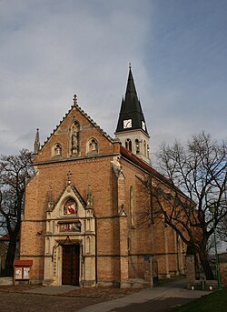
Church in Ilok
|
||
|
||
| Location of Ilok in Croatia | ||
| Coordinates: 45°13′N 19°23′E / 45.217°N 19.383°ECoordinates: 45°13′N 19°23′E / 45.217°N 19.383°E | ||
| Country |
|
|
| Region | Syrmia (Podunavlje) | |
| County |
|
|
| Government | ||
| • Mayor | Zvonimir Dragun (HSS) | |
| Elevation | 135 m (443 ft) | |
| Population (2011) | ||
| • Town | 6,767 | |
| • Urban | 5,072 | |
| Time zone | CET (UTC+1) | |
| • Summer (DST) | CEST (UTC+2) | |
| Postal code | 32236 | |
| Area code(s) | +385 (0)32 | |
| Website | ilok |
|
Ilok (Croatian pronunciation: [ilok]) is the easternmost town and municipality in northeastern Croatia, in Slavonia. Located in the Syrmia region, it lies on a hill overlooking the Danube river, which forms the border with the Vojvodina region of Serbia. The population of the town of Ilok is 5,072, while the total municipality population is 6,767 (census 2011). The town is home to a Franciscan monastery and Ilok Castle, which is a popular day trip for domestic tourists.
In Croatian, the town is known as Ilok, in German as Illok, in Hungarian as Újlak and in Turkish as Uyluk. In Hungarian language "Újlak" means "new dwelling or lodge".
The area of present-day Ilok was populated since the neolithic and Bronze Ages. The Romans settled there in the 1st or 2nd century and built Cuccium, the first border fortification on the Danube. The Slavs settled here in the 6th century, and the Croats arrived here probably after the collapse of the second Avar Khanate. The area was later ruled by the Bulgarian Empire, until it was included into the medieval Kingdom of Hungary.
In 12th and 13th centuries the market-town of Ilok was mentioned in documents under various names (Iwnlak, Vilak, Vylok, Wyhok, Wylak). At the end of the 13th century, Hungarian kings gave the Vylak castrum to the powerful Csák noble family. In the 13th and 14th centuries, Ilok was a capital of the semi-independent medieval state of Upper Syrmia ruled by Ugrin Csák.
...
Wikipedia


