Iffwil
| Iffwil | ||
|---|---|---|

Iffwil village entrance
|
||
|
||
| Coordinates: 47°4′N 7°29′E / 47.067°N 7.483°ECoordinates: 47°4′N 7°29′E / 47.067°N 7.483°E | ||
| Country | Switzerland | |
| Canton | Bern | |
| District | Bern-Mittelland | |
| Area | ||
| • Total | 13.5 km2 (5.2 sq mi) | |
| Elevation | 580 m (1,900 ft) | |
| Population (Dec 2015) | ||
| • Total | 5,609 | |
| • Density | 420/km2 (1,100/sq mi) | |
| Postal code | 3303 | |
| SFOS number | 0540 | |
| Surrounded by | Bangerten, Etzelkofen, Grafenried, Jegenstorf, Scheunen, Zuzwil | |
| Website |
www SFSO statistics |
|
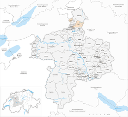
Iffwil is a municipality in the Bern-Mittelland administrative district in the canton of Bern in Switzerland.
Iffwil is first mentioned in 1148 as Iffenwilere.
Scattered neolithic items were found around the municipality and a Hallstatt grave mound was discovered in the Iffwilerwald.
A castle was mentioned near the village in 1346, though only the foundations remain. During the Middle Ages, a number of landowners owned part or all of the village, including the Counts of Kyburg and the Lords of Jegistorf and Seedorf. In 1332 the Lords of Seedorf sold land and the village low court to citizens of Bern. Between 1334 and 1361 most of these citizens sold or donated their holdings in the village to the Niedere Spital (Lower Hospital) in Bern. The Hospital appointed an administrator to manage the estates in Iffwil. The village of dorf ze Ober Iffwil (Upper Iffwil village) was last mentioned in 1356. Sometime after that date, the village was abandoned.
During the 20th century, the municipality has changed from a rural, agricultural village into a commuter town. The location near Bern and at the intersection of the Jegenstorf-Scheunen and Münchenbuchsee-Mülchi roads have encouraged commuters to settle in the municipality. The new neighborhoods of Bergacker and Dorf were built starting in 1965 to house the growing population. Currently, about two-thirds of the population commutes to jobs in nearby cities.
Iffwil has an area of 5.06 km2 (1.95 sq mi). Of this area, 2.79 km2 (1.08 sq mi) or 55.1% is used for agricultural purposes, while 1.84 km2 (0.71 sq mi) or 36.4% is forested. Of the rest of the land, 0.4 km2 (0.15 sq mi) or 7.9% is settled (buildings or roads).
Of the built up area, housing and buildings made up 2.6% and transportation infrastructure made up 5.1%. Out of the forested land, all of the forested land area is covered with heavy forests. Of the agricultural land, 46.8% is used for growing crops and 6.7% is pastures, while 1.6% is used for orchards or vine crops.
...
Wikipedia


