Horspath
| Horspath | |
|---|---|
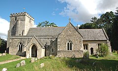
 St Giles' parish church |
|
| Horspath shown within Oxfordshire | |
| Area | 4.66 km2 (1.80 sq mi) |
| Population | 1,378 (2011 Census) |
| • Density | 296/km2 (770/sq mi) |
| OS grid reference | SP5704 |
| Civil parish |
|
| District | |
| Shire county | |
| Region | |
| Country | England |
| Sovereign state | United Kingdom |
| Post town | Oxford |
| Postcode district | OX33 |
| Dialling code | 01865 |
| Police | Thames Valley |
| Fire | Oxfordshire |
| Ambulance | South Central |
| EU Parliament | South East England |
| UK Parliament | |
| Website | Welcome to Horspath |
Horspath is a village and civil parish in South Oxfordshire about 3.5 miles (5.6 km) east of the centre of Oxford, England. The 2011 Census recorded the parish's population as 1,378.
The parish's western boundary largely follows the course of a Roman road that linked Dorchester on Thames and Alchester Roman Town. In the Romano-British period there were pottery kilns producing Oxfordshire red/brown-slipware at Horspath Open Brasenose. Production of red slipware had begun by about AD 240 and continued until the end of 4th century. Production at the Horspath kiln was from the mid-3rd century until the 4th century.
A wide range of red-slipped tables wares, often decorated with rouletting, stamps or white slip, was produced in the Oxfordshire potteries and widely distributed across Britain during the 3rd and 4th centuries AD. A Romano-British pottery mould has been found at Horspath and Roman pottery has been found on the allotments and on the common to the north of the village.
In the Middle Ages there were originally two distinct hamlets: Upper or Old Horspath and Nether, Lower or Church Horspath. The old packhorse road joining the London Road through the neighbouring village of Wheatley gave the village the Old English name of "Horsepadan", which became "Horsepath." Finally, in 1912 the Parish Council changed the village's name to the unique form "Horspath."
Horspath parish was once part of the medieval Royal Forest of Shotover, with dense woodland cover extending from Islip to Cuddesdon until "disafforestation" in 1660.
...
Wikipedia

