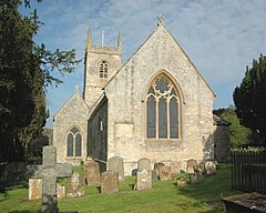
Islip, Oxfordshire
| Islip | |
|---|---|
 St. Nicholas the Confessor parish church |
|
| Islip shown within Oxfordshire | |
| Area | 6.42 km2 (2.48 sq mi) |
| Population | 652 (2011 Census) |
| • Density | 102/km2 (260/sq mi) |
| OS grid reference | SP5214 |
| Civil parish |
|
| District | |
| Shire county | |
| Region | |
| Country | England |
| Sovereign state | United Kingdom |
| Post town | Kidlington |
| Postcode district | OX5 |
| Dialling code | 01865 |
| Police | Thames Valley |
| Fire | Oxfordshire |
| Ambulance | South Central |
| EU Parliament | South East England |
| UK Parliament | |
| Website | Islip Village Oxfordshire |
Islip /ˈaɪslɪp/ is a village and civil parish on the River Ray, just above its confluence with the River Cherwell in Oxfordshire, England. It is about 2 miles (3 km) east of Kidlington and about 5 miles (8 km) north of Oxford. The 2011 Census recorded the parish's population as 652.
The remains of a Romano-British villa have been found about half a mile (800 metres) southwest of the village.
Edward the Confessor (born circa 1004, died 1066) was born in Islip and tradition holds that he was baptised in a church here. Parts of the present building date from about 1200. The chancel was rebuilt in 1780 and the church was restored in 1861. The church is Islip's only Grade I Listed Building. The belltower has a ring of eight bells. The Church of England parish is now part of the Benefice of the Ray Valley.
A chapel associated with Edward the Confessor used to exist north of the church. The chapel was damaged in April 1645 in a military engagement in the English Civil War, and in the 1780s it was demolished.
The former Rectory was built in 1689 for Robert South and enlarged in 1807 for William Vincent. It is Islip's only Grade II* Listed Building.
...
Wikipedia

