Hong Kong island
| 香港島 | |
|---|---|

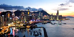
Dusk view of Hong Kong Island as seen from North Point.
|
|
|
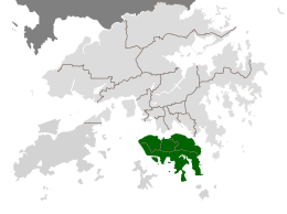
Location within Hong Kong |
|
| Geography | |
| Coordinates | 22°15′52″N 114°11′14″E / 22.26444°N 114.18722°ECoordinates: 22°15′52″N 114°11′14″E / 22.26444°N 114.18722°E |
| Area | 78.59 km2 (30.34 sq mi) |
| Highest elevation | 552 m (1,811 ft) |
| Highest point | Victoria Peak |
| Administration | |
|
|
|
| Chief Executive | CY Leung |
| Demographics | |
| Population | 1,289,500 (2008) |
| Pop. density | 16,390 /km2 (42,450 /sq mi) |
| Ethnic groups | 88.5%, Chinese, 4% Filipino, 2.4% Indonesian, 2.4% White |
| Hong Kong Island | |||||||||||||||||||||||||
| Traditional Chinese | 香港島 | ||||||||||||||||||||||||
|---|---|---|---|---|---|---|---|---|---|---|---|---|---|---|---|---|---|---|---|---|---|---|---|---|---|
| Simplified Chinese | 香港岛 | ||||||||||||||||||||||||
|
|||||||||||||||||||||||||
| Transcriptions | |
|---|---|
| Standard Mandarin | |
| Hanyu Pinyin | Xiāng gǎng dǎo |
| Wu | |
| Romanization | Shian平kaon上 tau上 |
| Hakka | |
| Romanization | Hiong1 gong3 dau3 |
| Yue: Cantonese | |
| Yale Romanization | Hēung góng dóu |
| Jyutping | Hoeng1 gong2 dou2 |
| Southern Min | |
| Hokkien POJ | Hiong-káng-tó |
Hong Kong Island (Chinese: 香港島) is an island in the southern part of Hong Kong. It has a population of 1,289,500 and its population density is 16,390/km², as of 2008[update]. The island had a population of about 3,000 inhabitants scattered in a dozen fishing villages when it was occupied by the United Kingdom in the First Opium War. In 1842, the island was formally ceded in perpetuity to the UK under the Treaty of Nanking and the City of Victoria was then established on the island by the British Force in honour of Queen Victoria.
The Central area on the island is the historical, political and economic centre of Hong Kong. The northern coast of the island forms the southern shore of the Victoria Harbour, which is largely responsible for the development of Hong Kong due to its deep waters favoured by large trade ships.
The island is home to many of the most famous sights in Hong Kong, such as "The Peak", Ocean Park, many historical sites and various large shopping centres. The mountain ranges across the island are also famous for hiking. The northern part of Hong Kong Island, together with Kowloon and Tsuen Wan New Town, forms the core urban area of Hong Kong. Their combined area is approximately 88.3 square kilometres (34.1 square miles) and their combined population (that of the northern part of the island and of Kowloon) is approximately 3,156,500, reflecting a population density of 35,700/km² (91,500/sq. mi.).
The island is often referred to locally as "Hong Kong side" or "Island side". This style was formerly applied to many locations (e.g. 'China-side' or even 'Kowloon Walled City-side') but is now only heard in this form and 'Kowloon side', suggesting the two sides of the harbour. The form was once more common in Britain than now, such as 'Surrey-side' and is still seen in British placenames like 'Cheapside', 'Tyneside', and 'Teesside', not all of which have an obvious watercourse or boundary with actual sides.
...
Wikipedia

