Homonna
| Humenné | |
| Town | |
|
A square in Humenné
|
|
| Country | Slovakia |
|---|---|
| Region | Prešov |
| District | Humenné |
| Tourism region | Horný Zemplín |
| River | Laborec |
| Elevation | 156 m (512 ft) |
| Coordinates | 48°56′09″N 21°54′24″E / 48.93583°N 21.90667°ECoordinates: 48°56′09″N 21°54′24″E / 48.93583°N 21.90667°E |
| Area | 28.762 km2 (11 sq mi) |
| Population | 34,634 (31 December 2012) |
| Density | 1,204/km2 (3,118/sq mi) |
| First mentioned | 1317 |
| Mayor | Jana Vaľová (Smer - SD) |
| Timezone | CET (UTC+1) |
| - summer (DST) | CEST (UTC+2) |
| Postal code | 066 01 |
| Phone prefix | 421-57 |
| Car plate | HE |
| Statistics: MOŠ/MIS | |
| Website: http://www.humenne.sk | |
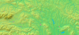
Humenné (![]() pronunciation ; Rusyn: Гуменне; German: Homenau; Hungarian: Homonna) is a town in the Prešov Region ("kraj") in eastern Slovakia and the second largest town of the historic Zemplín region. It lies at the volcanic Vihorlat mountains and at the confluence of the Laborec and Cirocha Rivers.
pronunciation ; Rusyn: Гуменне; German: Homenau; Hungarian: Homonna) is a town in the Prešov Region ("kraj") in eastern Slovakia and the second largest town of the historic Zemplín region. It lies at the volcanic Vihorlat mountains and at the confluence of the Laborec and Cirocha Rivers.
Humenné is a center of one of the easternmost districts ("okres") in Slovakia. The most attractive places are the Vihorlat Mountains boasting of their Morské oko lake, and the Poloniny (Wooden Carpathians) at the border of Slovakia, Poland, and Ukraine, which are part of the National Park Poloniny. Humenné is surrounded by ruins of medieval castles and an open-air museum of architecture situated in the town park.
Castles and mansions near Humenné:
The Laborec river and the Carpathian mountains predetermined the development of the town and its surroundings, a silent witness of which has been Vihorlat volcano, at 1,075 m (3,526.90 ft) the highest peak of the Vihorlat mountains. Thanks to its advantageous location and pleasant climate, preconditioned by the neighboring mountains, the town has been an attractive place for people since the Stone Age, which is evidenced by a number of archeological findings. The Slavic forefathers of the Slovaks gradually moved to the basin of Humenné during the great migration of peoples, starting in the 5th century.
...
Wikipedia


