Holden, Massachusetts
| Holden, Massachusetts | ||
|---|---|---|
| Town | ||

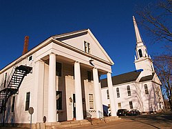
Holden Center
|
||
|
||
 Location in Worcester County and the state of Massachusetts. |
||
| Coordinates: 42°21′06″N 71°51′50″W / 42.35167°N 71.86389°WCoordinates: 42°21′06″N 71°51′50″W / 42.35167°N 71.86389°W | ||
| Country | United States | |
| State | Massachusetts | |
| County | Worcester | |
| Settled | 1723 | |
| Incorporated | 1741 | |
| Government | ||
| • Type | Open town meeting | |
| • Town Manager |
Jacqueline Kelly | |
| • Board of Selectmen |
Robert Lavigne Anthony M. Renzoni Jeremy Kurtz Mark Ferguson Kenneth Lipka |
|
| Area | ||
| • Total | 36.2 sq mi (93.8 km2) | |
| • Land | 35.0 sq mi (90.6 km2) | |
| • Water | 1.2 sq mi (3.2 km2) | |
| Elevation | 860 ft (262 m) | |
| Population (2010) | ||
| • Total | 17,346 | |
| • Density | 480/sq mi (180/km2) | |
| Time zone | Eastern (UTC-5) | |
| • Summer (DST) | Eastern (UTC-4) | |
| ZIP code | 01520 & 01522 | |
| Area code(s) | 508 / 774 | |
| FIPS code | 25-30560 | |
| GNIS feature ID | 0618365 | |
| Website | www |
|
Holden is a town in Worcester County, Massachusetts, United States. The town was founded in 1741, and the Town Square (center) was donated by John Hancock, former Governor of Massachusetts.
The population was 17,346 at the 2010 census.
Holden was named for Samuel Holden, a director of the Bank of England.
According to the United States Census Bureau, the town has a total area of 36.2 square miles (94 km2), of which 35.0 square miles (91 km2) is land and 1.2 square miles (3.1 km2), or 3.40%, is water. The landscape is dominated by hills and rivers, including the Quinapoxet.
Holden is bounded on the west by Rutland, on the northwest by Princeton, on the east by Sterling and West Boylston, on the southeast by Worcester, and on the southwest by Paxton.
As of the census of 2000, there were 15,621 people, 5,715 households, and 4,423 families residing in the town. The population density was 446.4 inhabitants per square mile (172.4/km2). There were 5,827 housing units at an average density of 166.5 per square mile (64.3/km2). The racial makeup of the town was 97.39% White, 0.49% African American, 0.10% Native American, 0.99% Asian, 0.01% Pacific Islander, 0.24% from other races, and 0.79% from two or more races. Hispanic or Latino of any race were 0.96% of the population.
...
Wikipedia

