Hillburn, New York
| Hillburn, New York | |
|---|---|
| Village | |
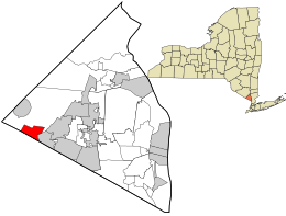
 Location in Rockland County and the state of New York. |
|
| Location within the state of New York | |
| Coordinates: 41°7′29″N 74°9′57″W / 41.12472°N 74.16583°WCoordinates: 41°7′29″N 74°9′57″W / 41.12472°N 74.16583°W | |
| Country | United States |
| State | New York |
| County | Rockland |
| Incorporated | 1893 |
| Government | |
| • Mayor | Craig M. Flanagan, Jr. |
| Area | |
| • Total | 2.2 sq mi (5.8 km2) |
| • Land | 2.2 sq mi (5.8 km2) |
| • Water | 0.0 sq mi (0.1 km2) |
| Elevation | 305 ft (93 m) |
| Population (2010) | |
| • Total | 951 |
| • Density | 430/sq mi (160/km2) |
| Time zone | Eastern (EST) (UTC-5) |
| • Summer (DST) | EDT (UTC-4) |
| ZIP code | 10931 |
| Area code(s) | 845 |
| FIPS code | 36-34660 |
| GNIS feature ID | 0952811 |
| Website | http://www.hillburn.org/ |
Hillburn, originally called "Woodburn" and incorporated in 1893, is a village in the town of Ramapo, Rockland County, New York, United States. It is located north of Suffern, east of Orange County, south of Viola, and west of Montebello. It is considered to be one of the more rural communities in Rockland County. The population was 951 at the 2010 census.
Hillburn is located at 41°7′29″N 74°9′57″W / 41.12472°N 74.16583°W (41.124812, -74.165966).
According to the United States Census Bureau, the village has a total area of 2.2 square miles (5.7 km2), of which 2.2 square miles (5.7 km2) is land and 0.04 square miles (0.10 km2), or 0.89%, is water.
As of the census of 2000, there were 881 people, 273 households, and 221 families residing in the village. The population density was 395.5 people per square mile (152.5/km²). There were 290 housing units at an average density of 130.2 per square mile (50.2/km²). The racial makeup of the village was 49.04% White, 11.12% African American, 14.42% Native American, 4.31% Asian, 0.68% Pacific Islander, 2.38% from other races, and 18.05% from two or more races. Hispanic or Latino of any race were 5.56% of the population.
...
Wikipedia

