Hempfield Township, Westmoreland County, Pennsylvania
| Hempfield Township, Westmoreland County, Pennsylvania |
|
|---|---|
| Township | |

Hempfield Township, with U.S. Route 30 and Westmoreland Mall in view
|
|
| Motto: "A Great Place to Raise a Family" | |
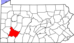
 Map of Westmoreland County, Pennsylvania Highlighting Hempfield Township |
|
 Map of Pennsylvania highlighting Westmoreland County |
|
| Country | United States |
| State | Pennsylvania |
| County | Westmoreland |
| Incorporated | April 6, 1773 |
| Area | |
| • Total | 76.8 sq mi (199 km2) |
| • Land | 76.6 sq mi (198 km2) |
| • Water | 0.2 sq mi (0.5 km2) |
| Population (2010) | |
| • Total | 43,241 |
| • Density | 531.5/sq mi (205.2/km2) |
| Time zone | Eastern (EST) (UTC-5) |
| • Summer (DST) | EDT (UTC-4) |
| Zip code | 15601 |
| Area code(s) | 724 |
| Website | http://www.hempfieldtwp.com |
Hempfield Township is a township in Westmoreland County, Pennsylvania, United States. The population was 43,241 at the 2010 census, making it the largest suburb in the Pittsburgh Metropolitan Area by population. Its name is taken from Hempfield in Lancaster County, which was formed in 1729 and is named after the hemp fields in the area.
Located in west-central Westmoreland County, the township completely surrounds the city of Greensburg.
According to the United States Census Bureau, the township has a total area of 76.8 square miles (199 km2), of which, 76.6 square miles (198 km2) of it is land and 0.2 square miles (0.52 km2) of it is water.
The township contains the following communities: Armbrust, Bovard, Carbon, Centerville, Darragh, Eastwood, Emmonston, Evanston, Fort Allen, Grapeville, Hannastown, Haydenville, High Park, Hunker, Lincoln Heights, Luxor, Maplewood Terrace, Midway, Radebaugh, St. Clair, Stonevilla, Swede Hill, White Hill, and West Point City.
As of the census of 2000, there were 40,721 people, 15,997 households, and 11,597 families residing in the township. The population density was 531.5 people per square mile (205.2/km²). There were 16,799 housing units at an average density of 219.2/sq mi (84.7/km²). The racial makeup of the township was 97.42% White, 1.11% Black or African American, 0.08% Native American, 0.84% Asian, 0.04% Pacific Islander, 0.11% from other races, and 0.40% from two or more races. Hispanic or Latino of any race were 0.38% of the population.
...
Wikipedia
