Height of Land Portage
| Height of Land Portage | |
|---|---|
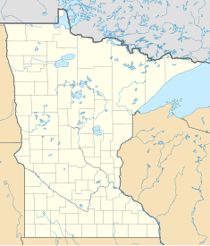
| Location | Cook County, Minnesota, USA / Thunder Bay District, Ontario, Canada |
| Nearest city | Grand Marais, Minnesota |
| Coordinates | 48°6′6″N 90°34′2″W / 48.10167°N 90.56722°WCoordinates: 48°6′6″N 90°34′2″W / 48.10167°N 90.56722°W |
| Area | 2 acres (0.81 ha) |
| Governing body | Federal |
| Designated | October 18, 1974 |
| Reference no. | 74001012 Search in MN for Height of Land; this is the one located in Cook County. |
Height of Land Portage is a portage along the historic Boundary Waters route between Canada and the United States. Located at the border of the Canadian province of Ontario and the U.S. state of Minnesota, the path is a relatively easy crossing of the Laurentian Divide separating the watersheds of the Atlantic and Arctic oceans.
It was used for centuries for canoe travel by the First Nations, and the historic route of which it was a part became a preindustrial thoroughfare giving the Voyageurs and Coureurs des bois access to the fur trading posts in western Canada. For many years the portage was part of an important route from Lower Canada to the interior of the North American continent. It became part of the boundary between British North America and the United States following the American Revolution and treaties delineating the border. In recognition of this history, the portage is on the U.S. National Register of Historic Places, and is a Minnesota State Historic Site.
Located in La Verendrye Provincial Park and the Boundary Waters Canoe Area Wilderness in the unspoiled country along the international boundary, the portage retains its traditional use, but for recreational canoe trips rather than commerce.
The portage, 80 rods (0.25 miles, or 402 m) long, crosses a low saddle between North Lake and South Lake in the Rove Formation. It adjoins the boundary vista, a cleared strip which marks the Canada–United States border between those lakes. South Lake is the source of the Arrow River, tributary to the Pigeon River, which flows east to Lake Superior, other Great Lakes, and the St. Lawrence River to the Atlantic Ocean. North Lake is in the watershed of the Rainy River, which drains by way of the Winnipeg and Nelson Rivers to Hudson Bay.
...
Wikipedia


