Harwood Heights, Illinois
| Harwood Heights | |
| Village | |
|
The Mont Clare at Harlem Avenue, formerly known as Parkway Towers
|
|
| Official name: Village of Harwood Heights | |
| Motto: A small town of big opportunities | |
| Country | United States |
|---|---|
| State | Illinois |
| County | Cook |
| Township | Norwood Park |
| Coordinates | 41°57′58″N 87°48′20″W / 41.96611°N 87.80556°WCoordinates: 41°57′58″N 87°48′20″W / 41.96611°N 87.80556°W |
| Area | 0.82 sq mi (2 km2) |
| - land | 0.82 sq mi (2 km2) |
| - water | 0.00 sq mi (0 km2) |
| Population | 8,612 (2010) |
| Density | 10,502.4/sq mi (4,055/km2) |
| Mayor | Arlene Jezierny |
| Timezone | CST (UTC-6) |
| - summer (DST) | CDT (UTC-5) |
| Postal code | 60706 |
| Area code | 708 |
|
Location in Cook County and the state of Illinois.
|
|
|
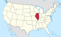
Location of Illinois in the United States
|
|
|
Website: www |
|
Harwood Heights is a village in Cook County, Illinois, United States. The population was 8,612 at the 2010 census. The current mayor is Arlene Jezierny. She is the second woman to serve as mayor in Harwood Heights, the first being Margaret Fuller.
Harwood Heights is located at 41°57′58″N 87°48′20″W / 41.96611°N 87.80556°W (41.966172, -87.805576).
According to the 2010 census, Harwood Heights has a total area of 0.82 square miles (2.12 km2), all land.
Harwood Heights is surrounded by Chicago and Norridge.
As of the census of 2000, there were 8,297 people, 3,505 households, and 2,183 families residing in the village. The population density was 10,094.4 people per square mile (3,906.7/km²). There were 3,606 housing units at an average density of 4,387.2 per square mile (1,697.9/km²). The racial makeup of the village was 92.13% White, 0.31% African American, 0.24% Native American, 4.42% Asian, 0.02% Pacific Islander, 1.54% from other races, and 1.33% from two or more races. Hispanic or Latino of any race were 5.83% of the population.
...
Wikipedia


