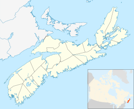
Hantsport, Nova Scotia
| Hantsport | ||
|---|---|---|
| Community | ||
|
||
| Motto: "The Haven of Hospitality" | ||
| Location of Hantsport, Nova Scotia | ||
| Coordinates: 45°5′0″N 64°11′0″W / 45.08333°N 64.18333°W | ||
| Country |
|
|
| Province |
|
|
| Municipality | Municipality of the District of West Hants | |
| Founded | 1789 | |
| Incorporated | April 25, 1895 | |
| Dissolved | July 1, 2015 | |
| Government | ||
| • Councilor | Robbie (Rob) Zwicker | |
| • MLA | Chuck Porter (PC) | |
| • MP | Scott Brison (L) | |
| Area | ||
| • Total | 2.13 km2 (0.82 sq mi) | |
| Population (2011) | ||
| • Total | 1,159 | |
| • Density | 544.6/km2 (1,411/sq mi) | |
| Time zone | AST (UTC-4) | |
| Postal code | B0P 1P0 | |
| Area code(s) | 902 | |
| Telephone Exchange | 684 | |
| Median Earnings* | $49,283 | |
| NTS Map | 021H01 | |
| GNBC Code | CBRNJ | |
| Website | hantsportnovascotia.com | |
|
||
Hantsport is a Canadian community located in Hants County, Nova Scotia. It is administratively part of the Municipality of the District of West Hants.
The community is located at the western boundary between Hants County and Kings County, along the west bank of the Avon River's tidal estuary. The community is best known for its former industries, including shipbuilding, a pulp mill, as well a marine terminal that once loaded gypsum,mined near Windsor. The community is the resting place of Victoria Cross recipient William Hall, VC.
The area around Hantsport was known to the Mi'kmaq as Kakagwek meaning "place where meat is sliced and dried" and the town is still home to a small reserve known as the Glooscap First Nation or Pesikitk.
Although no Acadians are known to have lived on the lands within the boundary of Hantsport proper, the area was part of the Acadian parish of Paroisse de Sainte Famille (established in 1698). Etienne Rivet and his progeny farmed the nearby marshlands of the Halfway River (currently the boundary between the town and the community of Mount Denson, Nova Scotia) and his son, Etienne, operated a mill on the river near where the marshlands meet the uplands on the town's southern boundary.
After the Expulsion of the Acadians, the Acadian region of Piziquid was formed into the Township of Falmouth. These lands were granted to New England Planters, and officers of the British army. Colonel Henry Denny Denson, a retired British officer, was granted an extensive tract of land (Mount Denson), which included the lands lying north of the Halfway River and south of the Horton Township boundary. In 1789, after Denson's death, his consort and heir, Martha Whitfield, sold Lots Three & Four (the area of Hantsport) to an Edward Barker.
...
Wikipedia


