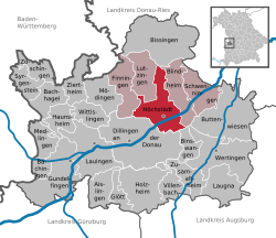
Höchstädt an der Donau
| Höchstädt an der Donau | ||
|---|---|---|
|
||
| Coordinates: 48°36′N 10°33′E / 48.600°N 10.550°ECoordinates: 48°36′N 10°33′E / 48.600°N 10.550°E | ||
| Country | Germany | |
| State | Bavaria | |
| Admin. region | Schwaben | |
| District | Dillingen | |
| Government | ||
| • Mayor | Hildegard Wanner | |
| Area | ||
| • Total | 37.45 km2 (14.46 sq mi) | |
| Elevation | 416 m (1,365 ft) | |
| Population (2015-12-31) | ||
| • Total | 6,663 | |
| • Density | 180/km2 (460/sq mi) | |
| Time zone | CET/CEST (UTC+1/+2) | |
| Postal codes | 89420 | |
| Dialling codes | 09074 | |
| Vehicle registration | DLG | |
| Website | www.hoechstaedt.de | |
Höchstädt an der Donau is a town in the district of Dillingen, Bavaria, Germany. It is situated near the banks of the River Danube. It consists of the following neighborhoods: Höchstädt an der Donau, Deisenhofen, Oberglauheim, Schwennenbach and Sonderheim. The town is the seat of the municipal association Höchstädt an der Donau, which includes the towns Blindheim, Finningen, Lutzingen and Schwenningen.
In the fifteenth and sixteenth century, the wealthy mercantile family Höchstetter, which came from the town, was part of the mercantile patriciate of Augsburg.
In the early 18th century, the town was the site of a battle twice. The first Battle of Höchstädt (German: Schlacht von Höchstädt) on 20 September 1703 cost over 5000 lives. A year later in 1704, the Battle of Blenheim (or Second Battle of Höchstädt also German: Schlacht von Höchstädt) between the Austrian and British forces (led by John Churchill, 1st Duke of Marlborough and Prince Eugene of Savoy) on the one side, and Bavarian and French troops (commanded by Maximilian II Emanuel, Elector of Bavaria, and the Comte de Tallard) on the other side.
...
Wikipedia


