Grenada County, Mississippi
| Grenada County, Mississippi | |
|---|---|
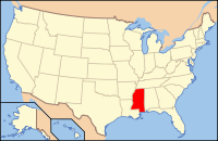
 Location in the U.S. state of Mississippi |
|
 Mississippi's location in the U.S. |
|
| Founded | 1870 |
| Named for | Granada |
| Seat | Grenada |
| Largest city | Grenada |
| Area | |
| • Total | 449 sq mi (1,163 km2) |
| • Land | 422 sq mi (1,093 km2) |
| • Water | 27 sq mi (70 km2), 6.1% |
| Population | |
| • (2010) | 21,906 |
| • Density | 52/sq mi (20/km²) |
| Congressional district | 2nd |
| Time zone | Central: UTC-6/-5 |
Grenada County is a county located in the U.S. state of Mississippi. As of the 2010 census, the population was 21,906. Its county seat is Grenada. The county is named for the province of Granada in southern Spain. Its western border is formed by the Yazoo River and it fronts on the Mississippi Delta. Cotton cultivation was important to its economy well into the 20th century.
The Grenada, MS Micropolitan Statistical Area includes all of Grenada County.
According to the U.S. Census Bureau, the county has a total area of 449 square miles (1,160 km2), of which 422 square miles (1,090 km2) is land and 27 square miles (70 km2) (6.1%) is water.
As of the 2010 United States Census, there were 21,906 people residing in the county. 56.9% were White, 41.7% Black or African American, 0.3% Asian, 0.2% Native American, 0.2% of some other race and 0.8% of two or more races. 0.9% were Hispanic or Latino (of any race).
As of the census of 2000, there were 23,263 people, 8,820 households, and 6,297 families residing in the county. The population density was 55 people per square mile (21/km²). There were 9,973 housing units at an average density of 24 per square mile (9/km²). The racial makeup of the county was 57.92% White, 40.93% Black or African American, 0.14% Native American, 0.34% Asian, 0.02% Pacific Islander, 0.13% from other races, and 0.52% from two or more races. 0.62% of the population were Hispanic or Latino of any race.
...
Wikipedia
