Greenfield Township, Blair County, Pennsylvania
| Greenfield Township, Blair County, Pennsylvania |
|
|---|---|
| Township | |

Schaefer Head, Blair County's highest point
|
|
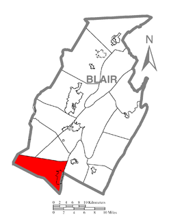
 Map of Blair County, Pennsylvania highlighting Greenfield Township |
|
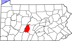
 Map of Blair County, Pennsylvania |
|
| Country | United States |
| State | Pennsylvania |
| County | Blair |
| Settled | 1770 |
| Incorporated | 1846 |
| Government | |
| • Type | Board of Supervisors |
| Area | |
| • Total | 36.3 sq mi (93.9 km2) |
| • Land | 36.3 sq mi (93.9 km2) |
| • Water | 0.0 sq mi (0.0 km2) |
| Population (2010) | |
| • Total | 2,279 |
| • Estimate (2016) | 4,053 |
| • Density | 115/sq mi (44.4/km2) |
| Time zone | Eastern (EST) (UTC-5) |
| • Summer (DST) | EDT (UTC-4) |
| Area code(s) | 814 |
| FIPS code | 42-013-31000 |
| Website | greenfieldtownshippa |
Greenfield Township is a township in Blair County, Pennsylvania, United States. It is part of the Altoona, PA Metropolitan Statistical Area. The population was 4,173 at the 2010 census.
Greenfield Township is located in the southwest corner of Blair County. It is bordered by Juniata Township and Freedom Township to the north and by Taylor Township to the northeast. Bedford County is to the south, and specifically Bloomfield Township to the southeast, Kimmel Township to the south, and Pavia Township to the southwest. Cambria County is to the west, with Summerhill Township touching Greenfield Township at its southwest corner and Portage Township sharing the western border.
The unincorporated community of Claysburg is the primary settlement in Greenfield Township, occupying the valley of the Frankstown Branch of the Juniata River near the eastern edge of the township. Interstate 99 passes to the east of Claysburg along the side of Dunning Mountain, with access from Exit 15 near the south edge of the township.
...
Wikipedia
