Juniata Township, Blair County, Pennsylvania
| Juniata Township, Blair County, Pennsylvania |
|
|---|---|
| Township | |
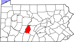
 Map of Blair County, Pennsylvania highlighting Juniata Township |
|
 Map of Blair County, Pennsylvania |
|
| Country | United States |
| State | Pennsylvania |
| County | Blair |
| Settled | 1800 |
| Incorporated | 1847 |
| Government | |
| • Type | Board of Supervisors |
| Area | |
| • Total | 26.1 sq mi (67.7 km2) |
| • Land | 26.1 sq mi (67.6 km2) |
| • Water | 0.04 sq mi (0.1 km2) |
| Population (2010) | |
| • Total | 2,279 |
| • Estimate (2016) | 1,099 |
| • Density | 43/sq mi (16.5/km2) |
| Time zone | Eastern (EST) (UTC-5) |
| • Summer (DST) | EDT (UTC-4) |
| Area code(s) | 814 |
| FIPS code | 42-013-38592 |
Juniata Township is a township in Blair County, Pennsylvania, United States. It is part of the Altoona, PA Metropolitan Statistical Area. The population was 1,112 at the 2010 census.
Juniata Township is located in southwestern Blair County, along the Cambria County line. It lies along the Allegheny Front, a major escarpment along the edge of the Allegheny Mountains in central Pennsylvania. The former alignment of U.S. Route 22 climbs the Front in the northern part of the township, though the current limited-access routing of US-22 runs farther to the north.
According to the United States Census Bureau, the township has a total area of 26.1 square miles (67.7 km2), of which 26.1 square miles (67.5 km2) is land and 0.04 square miles (0.1 km2), or 0.21%, is water.
As of the census of 2000, there were 1,115 people, 428 households, and 324 families residing in the township. The population density was 41.9 people per square mile (16.2/km²). There were 471 housing units at an average density of 17.7/sq mi (6.8/km²). The racial makeup of the township was 99.46% White, 0.09% African American, 0.09% Asian, 0.18% from other races, and 0.18% from two or more races. Hispanic or Latino of any race were 0.09% of the population.
...
Wikipedia
