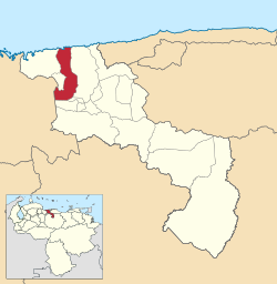
Girardot Municipality, Aragua
| Girardot | |||
|---|---|---|---|
| Municipality | |||
| Municipio Girardot | |||
|
|||
 Location in Aragua |
|||
| Country |
|
||
| State | Aragua | ||
| Shiretown | Maracay | ||
| Government | |||
| • Mayor | Pedro Bastidas (PSUV) | ||
| Area | |||
| • Total | 302 km2 (117 sq mi) | ||
| Population (2011) | |||
| • Total | 407,109 | ||
| • Density | 1,300/km2 (3,500/sq mi) | ||
| Time zone | VST (UTC-4:30) | ||
| Area code(s) | 0243 | ||
| Website | Official website | ||
The Girardot Municipality is one of the 18 municipalities (municipios) that makes up the Venezuelan state of Aragua. According to the 2011 census by the National Institute of Statistics of Venezuela, the municipality has a population of 407,109. The city of Maracay is the shire town of the Girardot Municipality.
The city of Maracay was officially established on March 5, 1701, by Bishop Diego de Baños y Sotomayor in the valleys of Tocopio and Tapatapa (what is known today as the central valley of Aragua) in northern Venezuela. According to the most accepted explanation, it was named after a local indigenous chief, and refers to the "Maracayo" (Felis mitis), a small tiger. Alternative etymologies cite a local aromatic tree called Mara.
Maracay experienced rapid growth during Juan Vicente Gómez's dictatorship (1908 - 1935). Gómez saw Maracay as a suitable place to make his residence during his rule, and ordered the construction of an Arc of Triumph, a bull plaza (a near replica of the one in Seville, Spain), an opera house, a zoo, and, most notably, the Hotel Jardín (Garden Hotel), a majestic, tourist attraction with very large gardens. The city is home to the Mausoleo de Gómez (Gómez's mausoleum), where the dictator's remains are stored.
The mountains on the north side of Maracay, that separate it from the coast, make up the Henri Pittier National Park, named after the Swiss naturalist that studied them. The park is a very lush rainforest, with a great variety of ferns. Two very winding roads cut through the park over the mountains to the coast. One, beginning at the North-Central part of the city known as Urbanización El Castaño, goes to the beach town of Choroní. The other, beginning at the North-Western part of the city known as Urbanización El Limón, goes to Ocumare de la Costa and the beaches of Cata and Catica.
...
Wikipedia


