Gaziantep
| Gaziantep | |
|---|---|
| Metropolitan municipality | |

Clockwise from top left: Gaziantep zoo; a view of the city center; Kamil Ocak Stadium; Uğur Plaza Hotel.
|
|
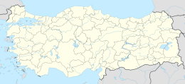
| Location of Gaziantep within Turkey. | |
| Coordinates: 37°04′N 37°23′E / 37.067°N 37.383°ECoordinates: 37°04′N 37°23′E / 37.067°N 37.383°E | |
| Country |
|
| Region | Southeastern Anatolia |
| Province | Gaziantep |
| Government | |
| • Mayor | Fatma Şahin (AKP) |
| Area | |
| • Total | 7.642 km2 (2.951 sq mi) |
| Population (2014) | |
| • Total | 1,556,381 |
| • Density | 212/km2 (550/sq mi) |
| Time zone | FET (UTC+3) |
| Postal code | 27x xx |
| Area code(s) | 342 & 343 |
| Licence plate | 27 |
| Website | www.gaziantep-bld.gov.tr |
Gaziantep (Turkish pronunciation: [ɡaːˈzianˌtep], Armenian: Այնթապ), previously and still informally called Antep (pronounced [anˈtep]), is a city in the western part of Turkey's Southeastern Anatolia Region, some 185 kilometres (115 mi) east of Adana and 97 kilometres (60 mi) north of Aleppo, Syria. The city has two urban districts under its administration, Şahinbey and Şehitkamil. It is the sixth most populous city in Turkey and one of the oldest continuously inhabited cities in the world. In 2014 the city of Gaziantep had a population of 1,465,019.
Gaziantep was formerly called Antep or Aïntab (عين تاب) in Ottoman Turkish, ˁAīntāb (عينتاب) in Arabic. There are several theories for the origin of the name:
The Crusaders called the city and its castle "Hantab", "Hamtab", and "Hatab".
In February 1921, the Turkish parliament named the city as غازى عينتاب "Ghazi Ayintab" 'Antep the war hero' for the Siege of Aintab, described as an "organised struggle of a group of genocide profiteers seeking to hold onto their loot" by Ümit Kurt referring to the Armenian Genocide, and that name was officially adopted in 1928 as Gaziantep.
...
Wikipedia

