Garrett County
| Garrett County, Maryland | |||
|---|---|---|---|

Garrett County Courthouse in December 2013
|
|||
|
|||
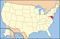
 Location in the U.S. state of Maryland |
|||
 Maryland's location in the U.S. |
|||
| Founded | November 4, 1872 | ||
| Named for | John Work Garrett | ||
| Seat | Oakland | ||
| Largest town | Mountain Lake Park | ||
| Area | |||
| • Total | 656 sq mi (1,699 km2) | ||
| • Land | 647 sq mi (1,676 km2) | ||
| • Water | 8.6 sq mi (22 km2), 1.3% | ||
| Population (est.) | |||
| • (2017) | 30,005 | ||
| • Density | 45/sq mi (17/km²) | ||
| Congressional district | 6th | ||
| Time zone | Eastern: UTC-5/-4 | ||
| Website | www |
||
Coordinates: 39°17′N 79°22′W / 39.283°N 79.367°W
Garrett County (gərɛt) is the westernmost county of the U.S. state of Maryland. As of the 2010 census, the population was 30,097, making it the third-least populous county in Maryland. Its county seat is Oakland. The county was named for John Work Garrett (1820–1884), president of the Baltimore and Ohio Railroad. Created from Allegany County, Maryland in 1872, it was the last Maryland county to be formed.
Garrett County has long been part of the media market of Pittsburgh, Pennsylvania. It is considered to be a part of Western Maryland.
The Commonwealth of Pennsylvania is to the north. The Maryland–Pennsylvania boundary was surveyed and marked between April 1765 and October 1767 by astronomer Charles Mason and surveyor Jeremiah Dixon. This boundary is commonly known as the Mason–Dixon line. The eastern border with Allegany County was defined by the Bauer Report, submitted to Governor Lloyd Lowndes, Jr. on November 9, 1898. The Potomac River and State of West Virginia lie to the south and west.
...
Wikipedia


