Allegany County, Maryland
| Allegany County, Maryland | |||
|---|---|---|---|
| County | |||
| Allegany County | |||

Allegany County Courthouse
|
|||
|
|||
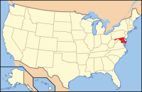
 Location in the U.S. state of Maryland |
|||
 Maryland's location in the U.S. |
|||
| Founded | December 25, 1789 | ||
| Named for | Allegheny Mountains | ||
| Seat | Cumberland | ||
| Largest city | Cumberland | ||
| Area | |||
| • Total | 430 sq mi (1,114 km2) | ||
| • Land | 424 sq mi (1,098 km2) | ||
| • Water | 5.8 sq mi (15 km2), 1.3% | ||
| Population (est.) | |||
| • (2015) | 72,528 | ||
| • Density | 169/sq mi (65/km²) | ||
| Congressional district | 6th | ||
| Time zone | Eastern: UTC-5/-4 | ||
| Website | gov |
||
Allegany County is a county located in the northwestern part of the U.S. state of Maryland. As of the 2010 census, the population was 75,087. Its county seat is Cumberland. The name Allegany may come from a local Lenape word, welhik hane or oolikhanna, which means 'best flowing river of the hills' or 'beautiful stream'. A number of counties in the Appalachian region of the US are named Allegany, Allegheny, or Alleghany.
Allegany County is part of the Cumberland, MD-WV Metropolitan Statistical Area. It is a part of the Western Maryland "panhandle".
The western part of Maryland (including the present Allegany County) was originally part of Prince George's County when Maryland was formed in 1696. This county included six current counties, and by repeated splitting, new ones were generated: Frederick from Prince George's in 1748; and Montgomery and Washington from Frederick in 1776.
Allegany County was formed in 1789 by the splitting of Washington County. At the time it was the westernmost county in Maryland, but a split in 1872 produced Garrett County, the current westernmost county.
Prior to 1789, the Virginia Commonwealth claimed the area of present-day Garrett and Allegheny Counties, of Maryland. A 1771-1780 map of Virginias counties, shows Hampshire County, but the Virginia State boundary has Hampshire outside that boundary line. When conducting genealogical research, it is possible to find tax records for Hampshire County, Virginia included in Maryland records, and Maryland records in Hampshire County... Hampshire County was formed in 1758 by the Virginia Commonwealth and at its founding, included the present day counties of Garrett & Allegheny Counties in Maryland, and Hardy, Grant, Mineral, and part of Morgan Counties in what is now West Virginia. Ref. Virginia Counties Map of 1771-1780; Henry Howe's 1845 History of Virginia.
...
Wikipedia


