Gallatin National Forest
| Gallatin National Forest | |
|---|---|
|
IUCN category VI (protected area with sustainable use of natural resources)
|
|
 |
|
| Location | Montana, USA |
| Nearest city | Bozeman, MT |
| Coordinates | 45°16′21″N 110°22′06″W / 45.27250°N 110.36833°WCoordinates: 45°16′21″N 110°22′06″W / 45.27250°N 110.36833°W |
| Area | 1,819,515 acres (7,363.32 km2) |
| Established | February 10, 1899 |
| Governing body | U.S. Forest Service |
| Website | Custer-Gallatin National Forest |
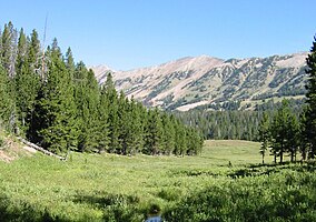
Founded in 1899, Gallatin National Forest is located in south central Montana, United States. The forest comprises 1,819,515 acres (7,363.32 km2) and has portions of both the Absaroka-Beartooth and Lee Metcalf Wilderness areas within its boundaries. Gallatin National Forest borders Yellowstone National Park on the north and northwest and is part of the Greater Yellowstone Ecosystem, a region which encompasses almost 20,000,000 acres (81,000 km2). The forest is named after Albert Gallatin (1761–1849), U.S. Secretary of the Treasury and scholar of Native American languages and cultures.
In descending order of land area the forest is located in parts of Park, Gallatin, Sweet Grass, Madison, Carbon, and Meagher counties.
Since 2014, the Gallatin and Custer National Forests are managed together as the Custer–Gallatin National Forest with headquarters in Bozeman, Montana. There are local ranger district offices located in West Yellowstone, Livingston and Gardiner in Montana for Gallatin, and Ashland and Red Lodge in Montana, and in Camp Crook in South Dakota for Custer.
...
Wikipedia

