Fuyun County
|
Fuyun County 富蕴县 • كوكتوعاي اۋدانى • كوكتوقاي ناھىيىسى (Chinese) • (Uyghur) • (Kazakh) |
|
|---|---|
| County | |
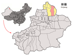
 Location of Fuyun County (red) in Altay Prefecture (yellow) and Xinjiang |
|
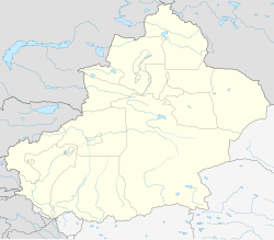
| Location of the seat in Xinjiang | |
| Coordinates: 47°13′N 89°39′E / 47.217°N 89.650°ECoordinates: 47°13′N 89°39′E / 47.217°N 89.650°E | |
| Country | People's Republic of China |
| Region | Xinjiang |
| Prefecture | Altay |
| Township-level divisions | 3 towns 6 townships 3 ethnic townships |
| County seat | Ku Ertix (库额尔齐斯镇) |
| Area | |
| • Total | 32,237 km2 (12,447 sq mi) |
| Dimensions | |
| • Length | 413 km (257 mi) |
| • Width | 180 km (110 mi) |
| Highest elevation | 3,863 m (12,674 ft) |
| Lowest elevation | 430 m (1,410 ft) |
| Population | |
| • Total | 80,000 |
| • Density | 2.5/km2 (6.4/sq mi) |
| Time zone | China Standard (UTC+8) |
| Postal code | 836100 |
Fuyun (Koktokay) County (simplified Chinese: 富蕴县; traditional Chinese: 富蘊縣; pinyin: Fùyùn Xiàn; Uyghur language: كوكتوقاي ناھىيىسى, Коктоқай Наһийиси, Koktoqay Nahiyisi) is a county situated in the Xinjiang Uyghur Autonomous Region and is under the administration of the Altay Prefecture. It has an area of 32,237 km² with a population of 80,000. The seat of Fuyun County is in Ku Ertix Town (库额尔齐斯镇). The Koktokay National Geopark is in Koktokay Town (可可托海镇). The Postcode of Fuyun County is 836100.
...
Wikipedia

