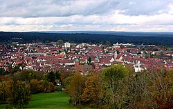
Freudenstadt
| Freudenstadt | ||
|---|---|---|
 |
||
|
||
| Coordinates: 48°27′48″N 8°24′40″E / 48.46333°N 8.41111°ECoordinates: 48°27′48″N 8°24′40″E / 48.46333°N 8.41111°E | ||
| Country | Germany | |
| State | Baden-Württemberg | |
| Admin. region | Karlsruhe | |
| District | Freudenstadt | |
| Government | ||
| • Mayor | Julian Osswald (CDU) | |
| Area | ||
| • Total | 87.58 km2 (33.81 sq mi) | |
| Population (2015-12-31) | ||
| • Total | 22,579 | |
| • Density | 260/km2 (670/sq mi) | |
| Time zone | CET/CEST (UTC+1/+2) | |
| Postal codes | 72250 | |
| Dialling codes | 07441, 07442, 07443 | |
| Vehicle registration | FDS | |
| Website | www |
|
Freudenstadt is a town in Baden-Württemberg in southern Germany. It is capital of the district Freudenstadt. The closest population centres are Offenburg to the west (approx. 36 km away) and Tübingen to the east (approx. 47 km away).
The city lies on a high plateau at the east edge of the north Black Forest, and is well known for its fresh air. Its city centre is famous as the largest market place in Germany. After Horb, it is the second largest city of the Freudenstadt district. The city has an administration partnership with the communities Bad Rippoldsau-Schapbach and Seewald.
Freudenstadt is a climatic health resort of international renown. In the 19th and 20th centuries, visitors of note included George V of the United Kingdom, the Queen of Sweden, John D. Rockefeller, and even the American writer Mark Twain. With its many hotels and guest houses, and its high-class cuisine, Freudenstadt remains a popular vacation spot for Germans from every part of the country. Among the many Germans of note who considered Freudenstadt a second home was the justice inspector Friedrich Kellner whose WWII diary is the subject of a Canadian documentary.
The building of Freudenstadt was ordered by duke Frederick of Württemberg in 1599. The designer was architect Heinrich Schickhardt.
In World War II, on the nearly 1,000 meter high Kniebis, not far from the Alexanderschanze, a Command Center of the Armed Forces was built to defend the Western Front: the Führer's headquarter Tannenberg. Heavy Anti-aircraft warfare positions with the associated supply and accommodation buildings were built in the area as part of the LVZ West (Western Air Defense Zone), especially on the Schliffkopf and the Hornisgrinde. In the Freudenstadt hospital many wounded were treated. Hitler's one-week visit to Tannenberg and Freudenstadt in 1940 (after the French campaign) at the inauguration of the headquarter was propaganda, which was reported in news reels. Thus, Freudenstadt including the nearby region in France has become a symbol of the Nazi regime and the French defeat, which in 1945 was to play an important role.
...
Wikipedia


