Kniebis
| Kniebis | |
|---|---|

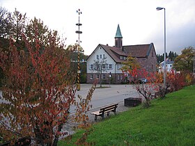
The evangelical church and primary school on the Kniebis
|
|
| Highest point | |
| Elevation | 960 m (3,150 ft) |
| Coordinates | 48°28′35″N 08°17′38″E / 48.47639°N 8.29389°ECoordinates: 48°28′35″N 08°17′38″E / 48.47639°N 8.29389°E |
| Geography | |
| Location | Baden-Württemberg, Germany |
The Kniebis is a 960-metre-high mountain ridge in the Black Forest and the name of a village to the south which is a dispersed settlement. The Kniebis mountain rises in the state of Baden-Württemberg, Germany.
The Kniebis lies on the Black Forest High Road that, as the B 28 federal highway approaches from Freudenstadt and continues from the mountain pass of Alexanderschanze as the B 500 to Baden-Baden. The B 28 itself continues to Kehl and Strasbourg. The Landesstraße 96 runs south in the direction of Hausach. The Kniebis is on the bus routes from Freudenstadt.
In winter there are numerous cross country skiing loipes, including one night trail with snow cannon and floodlights, as well as several ski lifts in the village and the surrounding area (Vogelskopf, Zuflucht and Kniebis lifts); in addition there is a toboggan run and various winter footpaths. In summer the Kniebis is a major mountain bike, Nordic walking and hiking area; in addition there is a fully renovated woodland lido. One nearby destination is the Lothar Path on the Black Forest High Road (B 500) in the direction of the Schliffkopf. On the western exit of the village is the Alexanderschanze, further north are the Röschenschanze and the Schwedenschanze.
...
Wikipedia
