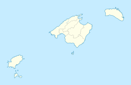
Formentera

Flag of Formentera
|
|
| Geography | |
|---|---|
| Location | Mediterranean Sea |
| Archipelago | Pityuses, Balearic Islands |
| Area | 83.24 km2 (32.14 sq mi) |
| Highest elevation | 119 m (390 ft) |
| Administration | |
| Autonomous community | Balearic Islands |
| Largest settlement | Sant Francesc Xavier |
| Demographics | |
| Population | 10,757 (1 January 2012) |
| Pop. density | 129.23 /km2 (334.7 /sq mi) |
| Additional information | |
| Official languages: Catalan, Spanish |
|
Formentera (Catalan pronunciation: [furmənˈteɾə], Spanish: [formenˈteɾa]) is the smaller and more southerly island of the Pityusic Islands group (comprising Ibiza and Formentera, as well as various small islets), which belongs to the Balearic Islands autonomous community (Spain).
The island's name is usually said to derive from the Latin word frumentarium, meaning "granary". The island had been occupied by the Carthaginians before passing to the ancient Romans. In succeeding centuries, it passed to the Visigoths, the Byzantines, the Vandals, and the Arabs. In 1109 it was the target of a devastating attack by the Norwegian king Sigurd I at the head of the "Norwegian Crusade". The island was conquered by the Catalans, added to the Crown of Aragon and later became part of the medieval Kingdom of Majorca.
The island (along with its surrounding islets) became a separate insular council (with the same territory as the municipality of the same name) after 1977. Before that, it was administered in the former insular council of Ibiza and Formentera (covering the whole group of the Pityusic Islands), but in a separate comarca (which already covered the current municipality of Formentera). This reform allowed Ibiza to unify its comarca (of five municipalities) with its new insular council (no longer administrating Formentera).
...
Wikipedia


