Emporia, VA
| Emporia, Virginia | ||
|---|---|---|
| Independent city | ||

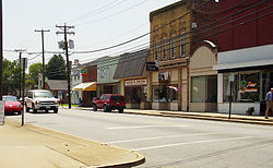
Downtown Emporia
|
||
|
||
| Nickname(s): "E-Town" | ||
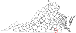
 Location in the Commonwealth of Virginia |
||
| Coordinates: 36°41′34″N 77°32′17″W / 36.69278°N 77.53806°W | ||
| Country | United States | |
| State | Virginia | |
| County | None (Independent city) | |
| Chartered | 1967 | |
| Government | ||
| • Mayor | Mary L. Person | |
| Area | ||
| • Total | 7.0 sq mi (18 km2) | |
| • Land | 6.9 sq mi (18 km2) | |
| • Water | 0.1 sq mi (0.3 km2) | |
| Elevation | 128 ft (39 m) | |
| Population (2013) | ||
| • Total | 6,170 | |
| • Density | 859/sq mi (332/km2) | |
| Time zone | EST (UTC-5) | |
| • Summer (DST) | EDT (UTC-4) | |
| ZIP code | 23847 | |
| Area code(s) | 434 | |
| FIPS code | 51-25808 | |
| GNIS feature ID | 1498475 | |
| Website | http://www.ci.emporia.va.us/ | |
Emporia is an independent city located within the confines of Greensville County, Virginia, United States. It and a predecessor town have been the county seat of Greensville County since 1791. As of the 2010 census, the population was 5,927, making it the second-least populous city in Virginia. The Bureau of Economic Analysis combines the city of Emporia with surrounding Greensville county for statistical purposes.
Emporia has long been a transportation crossroads. Although rivers further to the north empty into the James River and Chesapeake Bay, the Meherrin River, like the Nottoway River and the Blackwater River, empties to the southeast into Albemarle Sound. The Town of Hicksford (also sometimes called Hick's Ford) was settled in 1710 in the Virginia Colony, where the Fort Road of eastern Virginia crossed the Meherrin River en route to Fort Christanna, as well as on a major north-south trail used by native peoples and sometimes called the "Halifax road".
Greensville County separated from Brunswick county in 1781 and Hicksford became the county seat (court convening monthly at a nearby tavern). In May 1781, British Col. Banastre Tarleton's cavalry crossed at Hicksford while raiding Greensville and Southampton counties.
After statehood, the Virginia General Assembly recognized the Town of Belfield on the river's northern bank in 1798, and Hicksford on the southern bank the next year.
In the following decades, the surrounding area remained rural, and development in Hicksford exceeded that in Belfield. An 1847 account documented 12 to 20 dwellings in Hickford worth about $10,025 and Belfield's buildings at $3050, while in 1865 Hicksford's buildings were valued at $20,700 and Belfield's at $3650, although by 1885 Hicksford had only grown to $22,915 while Belfield had grown to 7300.
...
Wikipedia

