Greensville County, Virginia
| Greensville County, Virginia | ||
|---|---|---|

Greensville County Courthouse, also serving the City of Emporia
|
||
|
||
 Location in the U.S. state of Virginia |
||
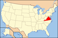
 Virginia's location in the U.S. |
||
| Founded | 1780 | |
| Seat | Emporia | |
| Largest town | Jarratt | |
| Area | ||
| • Total | 297 sq mi (769 km2) | |
| • Land | 295 sq mi (764 km2) | |
| • Water | 2 sq mi (5 km2), 0.5% | |
| Population (est.) | ||
| • (2015) | 11,885 | |
| • Density | 40/sq mi (15/km²) | |
| Congressional district | 4th | |
| Time zone | Eastern: UTC-5/-4 | |
| Website | www |
|
Greensville County is a county located in the Commonwealth of Virginia. As of the 2010 census, the population was 12,243. Its county seat is Emporia.
Greensville County was established in 1781 from Brunswick County. The county is probably named for Sir Richard Grenville, leader of the settlement on Roanoke Island, 1585. There is also belief that it may be named after Nathanael Greene, a major general of the Continental Army and one of George Washington's brightest officers.
An early chapter of the National Association for the Advancement of Colored People was formed in Greensville County and Emporia (the county seat) in May 1940, under the leadership of dentist Dr. F. A. Sealy, of Boydton, Virginia and president of the Mecklenburg County, Virginia branch. However he died in 1943, as efforts to desegregate the county's schools began with the assistance of attorneys Oliver W. Hill. After service in World War II, Hill's colleague Samuel W. Tucker moved to Emporia, married a schoolteacher and became the county's only African American attorney, as well as a leader in desegregating schools across Virginia.
According to the U.S. Census Bureau, the county has a total area of 297 square miles (770 km2), of which 295 square miles (760 km2) is land and 1.6 square miles (4.1 km2) (0.5%) is water.
...
Wikipedia

