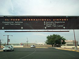
El Paso International Airport
| El Paso International Airport | |||||||||||||||||||
|---|---|---|---|---|---|---|---|---|---|---|---|---|---|---|---|---|---|---|---|
 |
|||||||||||||||||||
| Summary | |||||||||||||||||||
| Airport type | Public | ||||||||||||||||||
| Owner | City of El Paso | ||||||||||||||||||
| Operator | El Paso Aviation Department | ||||||||||||||||||
| Serves | El Paso, Texas; Las Cruces, New Mexico | ||||||||||||||||||
| Location | El Paso, Texas | ||||||||||||||||||
| Elevation AMSL | 3,958 ft / 1,206 m | ||||||||||||||||||
| Coordinates | 31°48′26″N 106°22′39″W / 31.80722°N 106.37750°WCoordinates: 31°48′26″N 106°22′39″W / 31.80722°N 106.37750°W | ||||||||||||||||||
| Website | elpasointernationalairport.com | ||||||||||||||||||
| Map | |||||||||||||||||||
| Location within Texas | |||||||||||||||||||
| Runways | |||||||||||||||||||
|
|||||||||||||||||||
| Statistics (2016) | |||||||||||||||||||
|
|||||||||||||||||||
|
Source: Federal Aviation Administration
|
|||||||||||||||||||
| Passengers | 2,807,734 |
|---|---|
| Aircraft operations | 79,148 |
El Paso International Airport (IATA: ELP, ICAO: KELP, FAA LID: ELP) is a public airport four miles (6 km) northeast of downtown El Paso, in El Paso County, Texas, US. It is the largest commercial airport in West Texas, handling 2,778,248 passengers in 2014. The airport serves the El Paso-Las Cruces CSA.
The city of El Paso built the first El Paso Municipal Airport near the east side of the Franklin Mountains in 1928. The airport was closed by 1945 and in more recent times has been home to the Jobe Concrete Products "Planeport" cement factory. In 1934, Varney Speed Lines (now United Airlines) operated at the original El Paso Municipal Airport (now closed). The original El Paso Municipal Airport construction was inspired by a visit from Charles Lindbergh.
What became the present-day El Paso International Airport was built as Standard Airport by Standard Airlines in 1929 for transcontinental air mail service. Standard Airlines became a division of American Airlines in the 1930s. In 1936, American Airlines "swapped" airports with the city of El Paso and El Paso International Airport was born.
During World War II, the airport was a United States Army Air Forces training base. Units which trained at El Paso Army Airfield were:
At the end of the war the airfield was deemed excess by the military and returned to the local government for civil use. The April 1952 C&GS diagram shows runways 4, 8, 12 and 17, each 7001 to 7062 ft long.
...
Wikipedia

