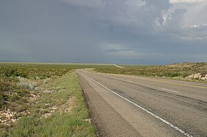
West Texas
| West Texas | |
| Region | |
|
West of Notrees
|
|
| Country | |
|---|---|
| State | |
West Texas is a vernacular term applied to a large region of the state of Texas, United States. Its boundaries are subject to debate but generally encompass the arid and semiarid lands west of a line drawn between Fort Worth and Del Rio, Texas.
A general lack of consensus exists regarding the boundaries that separate eastern and western Texas.Walter Prescott Webb, the American historian and geographer, suggested the 98th meridian separates East and West Texas. Texas writer A.C. Greene proposed that West Texas extends west of the Brazos River.
West Texas is often subdivided according to distinct physiographic features. The portion of West Texas that lies west of the Pecos River is often referred to as "Far West Texas" or the "Trans-Pecos", a term first introduced in 1887 by Texas geologist Robert T. Hill. The Trans-Pecos lies within the Chihuahuan Desert, the most arid portion of the state. Another part of West Texas is the Llano Estacado, a vast region of high, level plains extending into Eastern New Mexico and the Texas Panhandle. To the east of the Llano Estacado lies the “redbed country” of the Rolling Plains and to the south of the Llano Estacado lies the Edwards Plateau. The Rolling Plains and the Edwards Plateau subregions act as transitional zones between eastern and western Texas.
The counties included in the West Texas region vary depending on the organization. The Texas Counties.net website acknowledges the variations, and includes 70 counties in its definition, based on the five principal metropolitan areas it contains: El Paso, Lubbock, Abilene, Midland/Odessa, and San Angelo.
...
Wikipedia


