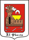
El Fuerte, Sinaloa
| El Fuerte | ||
|---|---|---|
|
||
| Location in Mexico | ||
| Coordinates: 26°25′17″N 108°37′12″W / 26.42139°N 108.62000°WCoordinates: 26°25′17″N 108°37′12″W / 26.42139°N 108.62000°W | ||
| Country |
|
|
| State | Sinaloa | |
| Municipality | El Fuerte | |
| Government | ||
| • Mayor | Eleazar Rubio Ayala (PRI) | |
| Elevation | 90 m (300 ft) | |
| Population (2010) | ||
| • Total | 12,566 | |
| Time zone | Mountain Time zone (UTC-7) | |
| • Summer (DST) | Pacific Daylight Time (UTC-6) | |
| Website | Government page | |
El Fuerte (Spanish ![]() [el 'fwerte] ) is a city and its surrounding municipality in the northwestern Mexican state of Sinaloa. The city population reported in the 2010 census were 12,566 people.
[el 'fwerte] ) is a city and its surrounding municipality in the northwestern Mexican state of Sinaloa. The city population reported in the 2010 census were 12,566 people.
El Fuerte, meaning "The Fort", was named "Pueblo Mágico" ("Magical Town") in 2009, for it has many attractions and a special, pretty-small-town Aura.
The city was founded in 1563 by the Spanish conquistador Francisco de Ibarra, the first explorer of the lofty Sierra Madre Occidental mountains. In 1610 a fort was built to ward off the fierce Zuaque and Tehueco Native Americans, who constantly harassed the Spaniards. For years, El Fuerte served as the gateway to the vast frontiers of the northern territories of Sonora, Arizona and California, all of which were sparsely populated by unyielding tribes of native amerindians.
For nearly three centuries it was the most important commercial and agricultural center of the vast northwestern region of Mexico. El Fuerte was a chief trading post for silver miners and gold seekers from the Urique and Batopilas mines in the nearby mountains of the Sierra Madre Occidental and its branches.
In 1824, El Fuerte became the capital city of the newly created Mexican state of Sonora y Sinaloa (reaching up deep into modern-day Arizona). It remained the capital for several years until the split of this state into the states of Sinaloa and Sonora.
...
Wikipedia


