El Aaiún
|
Laayoune العيون ⵍⵄⵢⵓⵏ El Aaiun |
|
|---|---|

Plaza de la Marcha Verde
|
|
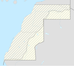
| Location in Western Sahara | |
| Coordinates: 27°9′13″N 13°12′12″W / 27.15361°N 13.20333°WCoordinates: 27°9′13″N 13°12′12″W / 27.15361°N 13.20333°W | |
| Non-Self-Governing Territory | Western Sahara |
| Region | Laâyoune-Sakia El Hamra |
| Province | Laâyoune Province |
| Settled | 1934 |
| Founded | 1938 |
| Population (2010) | |
| • Total | 196,331 |
| Time zone | UTC |
Laayoune (Maghrebi Arabic: لعيون, Laʕyūn ; Spanish: El Aaiún; French: Laâyoune; Berber: ⵍⵄⵢⵓⵏ, Leɛyun; Literary Arabic: العيون al-ʿuyūn, literally "The Springs") is the largest city of the disputed territory of Western Sahara. The modern city is thought to have been founded by the Spanish colonizer in 1938. In 1940, Spain designated it as the capital of the Spanish Sahara. Laâyoune (El-Aaiún) is the capital of the Laâyoune-Sakia El Hamra region administered by Morocco under the supervision of the UN peace-keeping mission in Western Sahara (MINURSO).
The town is divided in two by the dry river of Saguia el Hamra. On the south side is the old lower town, constructed by Spanish colonists. A cathedral from that era is still active; its priests serve this city and Dakhla further south.
Laâyoune or'El Aaiún are respectively the French and Spanish transliterations of the Maghrebi Arabic name Layoun which means "the water springs".
Laâyoune (El-Aaiún) has a mild desert climate, moderated by the Canary Current with an average annual temperature of 20 °C (68 °F).
The city has a population of 196,331 and is the largest city in Western Sahara. It is a growing economic hub.
The city is a hub for fishing and for phosphate mining in the region. In 2010 that country was negotiating a new fishing agreement with Europe over offshore fishing.
...
Wikipedia

