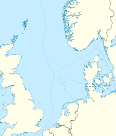
Ekofisk oil field
| Ekofisk | |
|---|---|

North Sea Oil Fields
|
|
| Location of Ekofisk | |
| Country | Norway |
| Location | Central North Sea |
| Blocks | 2/4, 2/7, 7/11 |
| Offshore/onshore | offshore |
| Coordinates | 56°32′57.11″N 3°12′35.95″E / 56.5491972°N 3.2099861°ECoordinates: 56°32′57.11″N 3°12′35.95″E / 56.5491972°N 3.2099861°E |
| Operator | ConocoPhillips Skandinavia AS |
| Partners |
Petoro Statoil Eni ConocoPhillips Total S.A. |
| Field history | |
| Discovery | 1969 |
| Start of production | 1971 |
| Production | |
| Current production of oil | 127,000 barrels per day (~6.33×10⁶ t/a) |
| Year of current production of oil | 2013 [1] |
| Producing formations | Ekofisk and Tor chalk formations (Early Paleocene and Late Cretaceous ages) |
Ekofisk is an oil field in block 2/4 of the Norwegian sector of the North Sea about 320 km (200 mi) southwest of Stavanger. Discovered in 1969 by Phillips Petroleum Company, it remains one of the most important oil fields in the North Sea. This was the first discovery of oil after the drilling of over 200 exploration wells in the North Sea "triggered" by the Groningen gas field discovery. In 1971, Phillips started producing directly to tankers from four subsea wells. Oil production is planned to continue until at least 2050.
Ekofisk reservoir consists of Cod, Ekofisk, West Ekofisk, Tor, Albuskjell, Eldfisk, Edda and Embla oil fields. The Ekofisk Center is a vast complex of platforms and structures creating a transportation hub also for surrounding fields such as Valhall, Hod, Gyda, Ula, Statfjord, Heimdal, Tommeliten and Gullfaks. The whole complex consists of 29 platforms. Produced oil is transported by the Norpipe oil pipeline to the Teesside Refinery in England. Natural gas is transported by the Norpipe gas pipeline to Emden in Germany.
The Ekofisk field is a central graben, north-south trending anticline 49 km2 (19 sq mi) in area, with 244 m (801 ft) of vertical closure and a hydrocarbon column 305 m (1,001 ft) long, formed by Permian Zechstein salt movement in the form of salt pillows. The production zones at a depth of about 3 km, include the Paleocene Ekofisk Formation and the Upper Cretaceous Tor Formation, both Chalk Group rocks containing porosities of 30-40%. "The reservoir rock...is a true chalk-a fine-grained limestone composed of the skeletal remains of pelagic unicellular golden-brown algae or coccolithophores". The source rocks are the Upper Jurassic Kimmeridgian shales.
...
Wikipedia

