Gullfaks oil field
| Gullfaks | |
|---|---|

Gullfaks A being completed near Haugesund
|
|
| Location of Gullfaks | |
| Country | Norway |
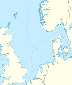
| Location | North Sea |
| Block | 34/10 |
| Offshore/onshore | offshore |
| Coordinates | 61°12′53.80″N 2°16′25.93″E / 61.2149444°N 2.2738694°ECoordinates: 61°12′53.80″N 2°16′25.93″E / 61.2149444°N 2.2738694°E |
| Operator | Statoil |
| Partners | Statoil, Petoro |
| Field history | |
| Discovery | 1978 |
| Start of production | 1986 |
| Peak of production | 180,000 barrels per day (29,000 m3/d) |
| Peak year | 2001 |
| Production | |
| Current production of oil | 39,000 barrels per day (~1.9×10⁶ t/a) |
| Year of current production of oil | 2013 [1] |
| Estimated oil in place | 73 million barrels (~1.0×10⁷ t) |
Gullfaks is an oil and gas field in the Norwegian sector of the North Sea operated by Statoil. It was discovered in 1978, in block 34/10, at a water depth of 130-230 meters. The initial recoverable reserve is 2.1 billion barrels (330×106 m3), and the remaining recoverable reserve in 2004 is 234 million barrels (37.2×10⁶ m3). This oil field reached peak production in 2001 at 180,000 barrels per day (29,000 m3/d). It has satellite fields Gullfaks South, Rimfaks, Skinfaks and Gullveig.
The project consists of three production platforms Gullfaks A (1986), Gullfaks B (1988), and Gullfaks C (1989). Gullfaks C sits 217 metres (712 ft) below the waterline. The height of the total structure measured from the sea floor is 380 metres (1,250 ft), making it taller than the Eiffel Tower. Gullfaks C produces 250,000 barrels per day (40,000 m3/d) of oil. The Tordis field, which is located 11 kilometres (6.8 mi) south east of Gullfaks C, has a subsea separation manifold installed in 2007 which is tied-back to the existing Gullfaks infrastructure.
Between November 2009 and May 2010 a well being drilled from Gullfaks C experienced multiple well control incidents which were investigated by Petroleum Safety Authority Norway and summarized in a report released on 19 November 2010. The report stated that only chance prevented the final and most serious incident on 19 May 2010 from becoming a full-scale disaster.
The reservoir consists of delta sandstones from the Middle Jurassic Brent Group, shallow-marine Lower Jurassic Cook Formation sandstones, and the fluvial-channel and delta-plain Lower Jurassic Statfjord Formation.
...
Wikipedia

