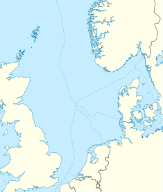
Statfjord oil field
| Statfjord | |
|---|---|

North Sea Fields
|
|
| Location of Statfjord | |
| Country | Norway, Scotland |
| Region | North Sea |
| Offshore/onshore | Offshore |
| Coordinates | 61°15′20″N 1°51′14″E / 61.25556°N 1.85389°ECoordinates: 61°15′20″N 1°51′14″E / 61.25556°N 1.85389°E |
| Operator | Statoil |
| Field history | |
| Start of production | 1979 |
| Peak of production | January 16, 1987 |
| Abandonment | 2019 |
| Production | |
| Current production of oil | 70,000 barrels per day (~3.5×10⁶ t/a) |
| Current production of gas | none |
The Statfjord oil field is an enormous oil and gas field covering 580 km2 in the U.K.-Norwegian boundary of the North Sea at a water depth of 145 m, discovered in 1974 by Mobil and since 1987 operated by Statoil.
It is a trans-median field crossing the Norwegian and UK North Sea Boundary with approximately 15% being in the UK Continental Shelf waters. At peak production it produced over 700,000 barrels (110,000 m3) of oil per day. Oil is loaded offshore and taken directly to refineries; gas is transported via the Statpipe pipeline to mainland Norway.
The Statfjord field has three condeep concrete production platforms, A, B and C. Each platform is made up of approximately 250,000 tonnes of concrete with 40,000 tonnes of top-side processing and accommodation facilities.
Statfjord holds the record for the highest daily production ever recorded for a European oil field (outside Russia) : 850,204 barrels (135,171.6 m3) (crude oil plus natural gas liquids) were produced on January 16, 1987.
Statoil has planned the "late life" of the field and expects to ultimately recover 68% of Oil in Place. but more than 60% have been produced already, leaving modest oil reserves in the order of 300 million barrels (48×106 m3), so the focus will now be placed on extracting the associated natural gas that had been re-injected into the field all over its life. As a mainly natural gas producer, Statfjord is scheduled to remain active until 2019.
The field is located in the northern part of the Viking Graben, north of the Viking Trough and east of the East Shetland Platform, in the same general area as the Brent oilfield discovered in 1971, and the Cormorant oilfield, Thistle oil field, Dunlin oilfield, Heather oil field and the Hutton oilfield, all discovered by 1973. A regional grid of reflection seismology lines showed the Brent structural trend extended into the area forming a "large northeast-trending and northwesterly tilted" (at 6-8 degrees) Fault block, partly eroded on the east flank, with Jurassic and Cretaceous shales trapping any oil in the Middle Jurrasic Brent deltaic and Late Triassic-Early Jurrasic Stratfjord fluvial sandstones originating from the Kimmeridge Clay Formation. The field is on the same structural trend but separated from the Brent Field, 20 km to the southwest, by normal faulting and a structural saddle.
...
Wikipedia

