Earlville, New York
| Earlville, New York | |
|---|---|
| Village | |

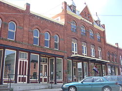
Earlville Opera House
|
|
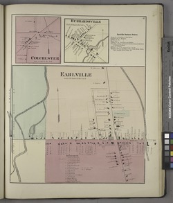
 Earlville in 1875 |
|
| Location within the state of New York | |
| Coordinates: 42°44′28″N 75°32′38″W / 42.74111°N 75.54389°WCoordinates: 42°44′28″N 75°32′38″W / 42.74111°N 75.54389°W | |
| Country | United States |
| State | New York |
| Counties | Madison, Chenango |
| Towns | Hamilton, Sherburne |
| Area | |
| • Total | 1.1 sq mi (2.8 km2) |
| • Land | 1.1 sq mi (2.8 km2) |
| • Water | 0.0 sq mi (0.0 km2) |
| Elevation | 1,099 ft (335 m) |
| Population (2010) | |
| • Total | 872 |
| • Density | 808/sq mi (311.9/km2) |
| Time zone | Eastern (EST) (UTC-5) |
| • Summer (DST) | EDT (UTC-4) |
| ZIP code | 13332 |
| Area code(s) | 315 Exchange:691 |
| FIPS code | 36-21523 |
| GNIS feature ID | 0948958 |
| Website | www |
Earlville is a village in New York, United States. The population was 872 at the 2010 census. The village is named after Jonas Earl, a canal commissioner.
Earlville lies on the border between Madison County and Chenango County and is partly in each county. The village is in the towns of Sherburne and Hamilton. The east–west thoroughfare, Main Street, runs along the county line.
The area was first settled around 1792 and was originally called "Forks" or "Madison Forks" until the current name was adopted around 1835 after development of the Chenango Canal. It was named for the builder of the Chenango Canal. After canal transportation waned, railroad service helped community commerce.
Earlville became an incorporated village in 1887. The Earlville Historic District was added to the National Register of Historic Places in 1982. The Earlville Opera House was listed in 1973 and houses a theater, two art galleries, an arts cafe, and an artisan gift shop.
Earlville is located at 42°44′28″N 75°32′38″W / 42.74111°N 75.54389°W (42.741079, -75.543827), positioned between the Chenango River to the west and the Sangerfield River, a tributary of the Chenango, to the east. The Chenango River is a south-flowing tributary of the Susquehanna River.
...
Wikipedia

