Chenango County, New York
| Chenango County, New York | ||
|---|---|---|
| County | ||

Chenango County Courthouse
|
||
|
||
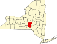
 Location in the U.S. state of New York |
||
 New York's location in the U.S. |
||
| Founded | March 15, 1798 | |
| Seat | Norwich | |
| Largest city | Norwich | |
| Area | ||
| • Total | 899 sq mi (2,328 km2) | |
| • Land | 894 sq mi (2,315 km2) | |
| • Water | 5.1 sq mi (13 km2), 0.6% | |
| Population | ||
| • (2010) | 50,477 | |
| • Density | 56/sq mi (22/km²) | |
| Congressional district | 22nd | |
| Time zone | Eastern: UTC-5/-4 | |
| Website | www |
|
Chenango County is a county located in the south-central section U.S. state of New York. As of the 2010 census, the population was 50,477. Its county seat is Norwich. The county's name originates from an Oneida word meaning "large bull-thistle."
This was long the territory of the Oneida people, one of the first Five Nations of the Iroquois Confederacy or Haudenosaunee. They occupied the area until after the Revolutionary War, when they were forced off the land, although they had been allies of the patriot colonists. They were granted a small reservation, which settlers continued to encroach on.
When English colonists organized counties in 1683 in what is now New York, the present Chenango County was part of Albany County. This was an enormous county, including the northern part of New York State as well as all of the present State of Vermont and, in theory, extending westward to the Pacific Ocean. But, territories located to the west of present-day Pennsylvania were under effective French control as part of New France. Albany County was reduced in size on July 3, 1766, by the creation of Cumberland County, and further on March 16, 1770, by the creation of Gloucester County, both containing territory now in Vermont.
On March 12, 1772, what was left of Albany County was split into three parts, one remaining under the name Albany County. One of the other pieces, Tryon County, contained the western portion (and thus, since no western boundary was specified, theoretically still extended west to the Pacific). The eastern boundary of Tryon County was approximately five miles west of the present city of Schenectady, and the county included the western part of the Adirondack Mountains and the area west of the West Branch of the Delaware River. The area then designated as Tryon County has since been organized as 37 counties of New York State. The county was named for William Tryon, the British colonial governor of New York.
...
Wikipedia

