
Dunningen
| Dunningen | ||
|---|---|---|
|
||

Dunningen
|
||
|
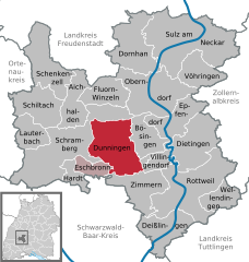
Location of Dunningen within Rottweil district
  |
||
| Coordinates: 48°12′41″N 08°30′26″E / 48.21139°N 8.50722°ECoordinates: 48°12′41″N 08°30′26″E / 48.21139°N 8.50722°E | ||
| Country | Germany | |
| State | Baden-Württemberg | |
| Admin. region | Freiburg | |
| District | Rottweil | |
| Government | ||
| • Mayor | Stephan Kröger | |
| Area | ||
| • Total | 48.44 km2 (18.70 sq mi) | |
| Elevation | 677 m (2,221 ft) | |
| Population (2015-12-31) | ||
| • Total | 6,091 | |
| • Density | 130/km2 (330/sq mi) | |
| Time zone | CET/CEST (UTC+1/+2) | |
| Postal codes | 78655 | |
| Dialling codes | 07403, 07402 | |
| Vehicle registration | RW | |
| Website | www.dunningen.de | |

Dunningen is a town in the district of Rottweil, in Baden-Württemberg, Germany.
Dunningen is located at the centre of the administrative district of Rottweil in the south western part of Baden-Wuerttemberg, Germany. The village is located in the shell limestone area between the Black Forest and the Swabian Alps on a strip of open country that crosses the district from north to south and that is mainly used for agriculture.
It is located on the eastern slope of the central part of the Black Forest, which borders on the Oberen Gäuen in the west.
From an infrastructural perspective, Dunningen is located advantageously on the B462, which is the main road between Schramberg and Rottweil.
Switzerland, as well as Lake Constance, can be reached in one hour, Austria in two hours by car. The French region of Alsace lies to the east and is also within easy reach.
The Eschach, which is a tributary of the Neckar, passes through Seedorf, Lackendorf and Dunningen.
Dunningen shares municipal boundaries with Waldmössingen, Beffendorf, Bösingen, Villingendorf, Hochwald, Zimmerm ob Rottweil, Eschbronn and Sulgen.
Administratively, Waldmössingen and Sulgen, which are located in northern and western direction, are part of the city of Schramberg, whereas Hochwald in southern and Beffendorf in northern direction belong respectively to the cities of Rottweil and Oberndorf.
The municipality consists of three districts which are Dunningen, Seedorf and Lackendorf. The district of Dunningen includes the village itself, the villers Auf der Stampfe and Frohnhof, the farms Eichhof, Gifizenmoos, Stittholz, Staudenrain and Beckenwäldle and the dwelling place Hindenburg. The districts of Lackendorf and Seedorf include in each case the two villages themselves.
The foundation of the village dates back to the Romans, as a Roman road and a Villa Rustica - a Roman farm - were found in the area. Moreover, there is proof of a Roman fort in the neighbouring village of Waldmössingen. Dunningen was first mentioned in a deed of gift from Count Gerold (+799) to the monastery of St. Gallen in year 786. The village was independent until it became part of the imperial city of Rottweil in 1435.
After the Principal Decree of the Imperial Deputation in 1803, the village became part of Wurttemberg and was integrated into the newly created city district of Rottweil.
...
Wikipedia