Dunlop, Australian Capital Territory
|
Dunlop Canberra, Australian Capital Territory |
|||||||||||||||
|---|---|---|---|---|---|---|---|---|---|---|---|---|---|---|---|

A Dunlop suburb sign at a local park.
|
|||||||||||||||
 |
|||||||||||||||
| Coordinates | 35°11′44″S 149°01′12″E / 35.19556°S 149.02000°ECoordinates: 35°11′44″S 149°01′12″E / 35.19556°S 149.02000°E | ||||||||||||||
| Population | 7,197 (2016 census) | ||||||||||||||
| • Density | 1,999/km2 (5,180/sq mi) | ||||||||||||||
| Gazetted | 22 September 1993 | ||||||||||||||
| Postcode(s) | 2615 | ||||||||||||||
| Area | 3.6 km2 (1.4 sq mi) | ||||||||||||||
| District | Belconnen | ||||||||||||||
| Territory electorate(s) | Ginninderra | ||||||||||||||
| Federal Division(s) | Fenner | ||||||||||||||
|
|||||||||||||||
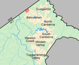
Dunlop is a suburb of the Belconnen district of Canberra, located within the Australian Capital Territory, Australia. Dunlop is at the far north-west edge of Canberra, near the border with the state of New South Wales. Approximately 11.6 kilometres (7.2 mi) north-west of the city, Dunlop is next to the suburbs of Fraser, Charnwood and Macgregor. At the edge and within Dunlop lies the Canberra Nature Park called Dunlop Grasslands Nature Reserve, West Belconnen Ponds, Jarramlee Pond and Fassifern Pond which are part of the Ginninderra Catchment.
Dunlop is named after Lieutenant Colonel Sir Ernest Edward 'Weary' Dunlop AC CMG OBE who was an Australian surgeon and was renowned for his leadership whilst being held prisoner of war by the Japanese during World War II. He was born in Wangaratta, Victoria, Australia. Streets in Dunlop are named after inventors, inventions and artists.
...
Wikipedia
