Dum Dum Airport
| Netaji Subhas Chandra Bose International Airport | |||||||||||||||
|---|---|---|---|---|---|---|---|---|---|---|---|---|---|---|---|
 |
|||||||||||||||
 |
|||||||||||||||
| Summary | |||||||||||||||
| Airport type | Public | ||||||||||||||
| Owner | Airports Authority of India | ||||||||||||||
| Serves | Kolkata metropolitan area | ||||||||||||||
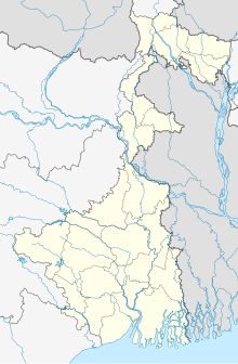
| Location | Jessore Road, Dum Dum, Kolkata - 52, West Bengal | ||||||||||||||
| Hub for | |||||||||||||||
| Elevation AMSL | 5 m / 16 ft | ||||||||||||||
| Coordinates | 22°39′17″N 088°26′48″E / 22.65472°N 88.44667°ECoordinates: 22°39′17″N 088°26′48″E / 22.65472°N 88.44667°E | ||||||||||||||
| Website | www |
||||||||||||||
| Map | |||||||||||||||
| Runways | |||||||||||||||
|
|||||||||||||||
| Statistics (April 2016 - March 2017) | |||||||||||||||
|
|||||||||||||||
|
Source: AAI
|
|||||||||||||||
| Passenger movements | 15,819,539 |
|---|---|
| Aircraft movements | 124,154 |
| Cargo tonnage | 152,415 |
Netaji Subhas Chandra Bose International Airport (IATA: CCU, ICAO: VECC) is an international airport located in Kolkata, West Bengal, India, serving the Kolkata metropolitan area. It is located approximately 17 km (11 mi) from the city center. The airport was earlier known as Dum Dum Airport before being renamed after Netaji Subhas Chandra Bose, a prominent leader of the Indian independence movement.
Spread over an area of 2,460 acres (1,000 ha), Kolkata airport is the largest hub for air traffic in the eastern part of the country and one of two international airports operating in West Bengal, the other one being in Bagdogra. The airport handled over 15.8 million passengers in fiscal year 2016-17 making it the fifth busiest airport in India in terms of passenger traffic after Delhi, Mumbai, Bangalore and Chennai. The Airport is a major centre for flights to Northeast India, Bangladesh, Bhutan, China and Southeast Asia. In 2014 & 2015, Kolkata Airport won the titles of Best Improved Airport in the Asia-Pacific region by the Airport Council International.
...
Wikipedia


