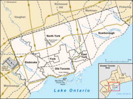
Dovercourt Park
| Dovercourt Park | |
|---|---|
| Neighbourhood | |
 |
|
| Location within Toronto | |
| Coordinates: 43°39′54″N 79°25′55″W / 43.665°N 79.432°WCoordinates: 43°39′54″N 79°25′55″W / 43.665°N 79.432°W | |
| Country |
|
| Province |
|
| City |
|
| Government | |
| • City Councillor |
Ana Bailão (Ward 18) Mike Layton (Ward 19) |
| • Federal M.P. |
Andrew Cash (Davenport) Adam Vaughan (Trinity—Spadina) |
| • Provincial M.P.P. |
Cristina Martins (Davenport) Han Dong (Trinity—Spadina) |
Dovercourt Park is a neighbourhood in Toronto, Ontario, Canada situated north of Bloor Street between Christie Street to the east, the CPR railway lines to the north, and Dufferin Street to the west.
The Village of Dovercourt was founded in the 1870s. Its residents were originally poor immigrants from England living in dozens of one and two bedroom tar and paper shacks which initially resulted in the village being called a shantytown.
The village was annexed by the old City of Toronto in 1912 resulting in city services being extended to the neighbourhood helping stimulate its growth and development by 1923.
The name Dovercourt comes from the name of the home of the Denison estate, located west of Dundas and Ossington.
The neighbourhood contains a mixture of land-uses. The main thoroughfare of Bloor Street consists almost exclusively of mixed-use residential and commercial buildings. The Bloorcourt Village BIA posts its streetlamp banners on Bloor between Dufferin and Montrose.
The buildings along Bloor Street are typically two or three stories tall, with retail commercial on the main floor, and offices or rental housing on the remainder. These converted residential structures are the oldest in the district and are often in poor repair. Pigeon infestation remains an issue for tenants. At Dovercourt Road, a large, high-rise apartment complex houses lower-middle-income tenants on the southwest corner.
Businesses on Dovercourt and Hallam, centred on the intersection of Dovercourt Road and Hallam Street have formed their own BIA, the 'Dovercourt Village'. The boundaries stretch from Dupont south to Shanley and east-west from Salem to Ossington Avenue.
The residential area north of Bloor Street is primarily single-family dwellings. Many of these structures have been converted into apartments, housing up to eight separate units. Side-streets increase in zoned density as they approach Bloor. Low and medium-rise apartments occupy the majority of these zones.
To the north, between Dupont and Davenport, is mainly post-industrial development. Limited manufacturing remains, although some warehouse and light automotive industries still exist. While the Canadian Pacific Railway operates a main line between the two thoroughfares, a large amount of former industrial space has been converted to loft condominia. Some single-family rowhouses and low-income rental space has also been created.
...
Wikipedia

