Douglassville, Texas
| Douglassville, Texas | |
|---|---|
| Town | |
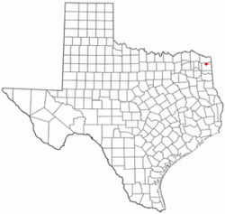
 Location of Douglassville, Texas |
|
 |
|
| Coordinates: 33°11′31″N 94°21′6″W / 33.19194°N 94.35167°WCoordinates: 33°11′31″N 94°21′6″W / 33.19194°N 94.35167°W | |
| Country | United States |
| State | Texas |
| County | Cass |
| Government | |
| • Type | Council-Manager |
| • City Council |
Mayor Douglass Heath Jana Granberry Scott Dupree Kay Gilbert Dewitt McCall Jessica Wylie Linda Baird |
| Area | |
| • Total | 6.3 sq mi (16.4 km2) |
| • Land | 6.3 sq mi (16.4 km2) |
| • Water | 0.0 sq mi (0.0 km2) |
| Elevation | 394 ft (120 m) |
| Population (2010) | |
| • Total | 229 |
| • Density | 36/sq mi (14.0/km2) |
| Time zone | Central (CST) (UTC-6) |
| • Summer (DST) | CDT (UTC-5) |
| ZIP code | 75560 |
| Area code(s) | 903 |
| FIPS code | 48-21112 |
| GNIS feature ID | 1334570 |
Douglassville is a town in Cass County, Texas, United States. The population was 229 at the 2010 census, up from 175 at the 2000 census.
Douglassville is located in northern Cass County at 33°11′31″N 94°21′06″W / 33.191927°N 94.351617°W, at the intersection of Texas Highways 8 and 77. Highway 8 leads north 10 miles (16 km) to Maud and south 13 miles (21 km) to Linden, the Cass County seat, while Highway 77 leads southeast 13 miles (21 km) to Atlanta and west 19 miles (31 km) to Naples.
According to the United States Census Bureau, Douglassville has a total area of 6.3 square miles (16.4 km2), all of it land.
As of the census of 2000, there were 175 people, 76 households, and 52 families residing in the town. The population density was 27.7 people per square mile (10.7/km2). There were 87 housing units at an average density of 13.8 per square mile (5.3/km2). The racial makeup of the town was 83.43% White, 15.43% African American, 0.57% Native American, and 0.57% from two or more races. Hispanic or Latino of any race were 0.57% of the population.
...
Wikipedia
