Douglas County, Wisconsin
| Douglas County, Wisconsin | |
|---|---|

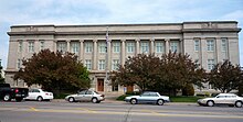
Douglas County Courthouse in Superior
|
|
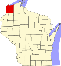
 Location in the U.S. state of Wisconsin |
|
 Wisconsin's location in the U.S. |
|
| Founded | February 8, 1854 |
| Named for | Stephen A. Douglas |
| Seat | Superior |
| Largest city | Superior |
| Area | |
| • Total | 1,480 sq mi (3,833 km2) |
| • Land | 1,304 sq mi (3,377 km2) |
| • Water | 176 sq mi (456 km2), 12% |
| Population (est.) | |
| • (2014) | 43,698 |
| • Density | 34/sq mi (13/km²) |
| Congressional district | 7th |
| Time zone | Central: UTC-6/-5 |
| Website | www |
Douglas County is a county located at the northwest corner of the U.S. state of Wisconsin. As of the 2010 census, the population was 44,159. Its county seat is Superior.
Douglas County is included in the Duluth, MN-WI Metropolitan Statistical Area.
Douglas County, named after Illinois Senator Stephen A. Douglas, was established on February 8, 1854, from the larger La Pointe County, Wisconsin, and the City of Superior was immediately selected as the county seat.
In Wisconsin's 1952 U.S. Senate primary, Douglas County was one of two counties (out of 71 in the state at the time) that Sen. Joe McCarthy did not carry.
According to the U.S. Census Bureau, the county has a total area of 1,480 square miles (3,800 km2), of which 1,304 square miles (3,380 km2) is land and 176 square miles (460 km2) (12%) is water.
A portion of the Fond du Lac Indian Reservation is located within Douglas County.
As of the 2010 United States Census, there were 44,159 people residing in the county. 93.2% were White, 2.0% Native American, 1.1% Black or African American, 0.9% Asian, 0.2% of some other race and 2.7% of two or more races. 1.1% were Hispanic or Latino (of any race). 20.7% were of German, 11.2% Norwegian, 9.7% Swedish, 7.8% Irish, 6.4% Finnish and 6.1% Polish ancestry.
...
Wikipedia
