Dockweiler
| Dockweiler | ||
|---|---|---|
|
||
| Coordinates: 50°15′07″N 6°46′57″E / 50.25194°N 6.78250°ECoordinates: 50°15′07″N 6°46′57″E / 50.25194°N 6.78250°E | ||
| Country | Germany | |
| State | Rhineland-Palatinate | |
| District | Vulkaneifel | |
| Municipal assoc. | Daun | |
| Government | ||
| • Mayor | Bruno von Landenberg | |
| Area | ||
| • Total | 6.05 km2 (2.34 sq mi) | |
| Elevation | 535 m (1,755 ft) | |
| Population (2015-12-31) | ||
| • Total | 667 | |
| • Density | 110/km2 (290/sq mi) | |
| Time zone | CET/CEST (UTC+1/+2) | |
| Postal codes | 54552 | |
| Dialling codes | 06595 | |
| Vehicle registration | DAU | |
| Website | www.dockweiler-web.de | |
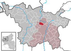
Dockweiler is an Ortsgemeinde – a municipality belonging to a Verbandsgemeinde, a kind of collective municipality – in the Vulkaneifel district in Rhineland-Palatinate, Germany. It belongs to the Verbandsgemeinde of Daun, whose seat is in the like-named town.
The municipality lies on the watershed between the Ahr and the Moselle in the heart of the Vulkaneifel, a part of the Eifel known for its volcanic history, geographical and geological features, and even ongoing activity today, including gases that sometimes well up from the earth. Dockweiler lies in the north of Rhineland-Palatinate at an elevation of roughly 500 to 560 m above sea level between Daun and Gerolstein.
A lava flow stretching from the Ernstberg (700 m) and across the Eselsberg (637 m), ending just before the neighbouring village of Dreis, forms the bedrock under Dockweiler.
In 1136, Dockweiler had its first documentary mention in the Springiersbach Monastery’s directory of holdings. Finds of coins, Roman burial mounds and settlement centres near Dockweiler as well as the proximity to the former Meuse-Rhine and Meuse-Moselle Roman roads are taken as evidence of Dockweiler’s founding going as far back as Roman times, although this cannot be confirmed.
...
Wikipedia


