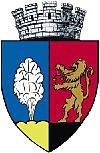
Dicsőszentmárton
| Târnăveni | ||
|---|---|---|
| Municipality | ||

Târnava-Mică County Prefecture, formerly Kis-Küküllő County Hall
|
||
|
||
| Location of Târnăveni | ||
| Coordinates: 46°19′47″N 24°16′12″E / 46.32972°N 24.27000°E | ||
| Country |
|
|
| County | Mureș County | |
| Status | Municipality | |
| Government | ||
| • Mayor | Sorin Megheșan (National Liberal Party) | |
| Area | ||
| • Total | 52.68 km2 (20.34 sq mi) | |
| Population (2011) | ||
| • Total | 22,075 | |
| Time zone | EET (UTC+2) | |
| • Summer (DST) | EEST (UTC+3) | |
| Website | http://www.primariatarnaveni.ro/ | |
Coordinates: 46°19′47″N 24°16′12″E / 46.32972°N 24.27000°E
Târnăveni (Romanian pronunciation: [tɨrnəˈvenʲ]; Hungarian: Dicsőszentmárton, Hungarian pronunciation: [ˈdit͡ʃøːsɛntmaːrton]; German: Sankt Martin, earlier Marteskirch) is a city in Mureș County, central Romania. It lies on the Târnava Mică River in central Transylvania. The city administers three villages: Bobohalma (Bábahalma), Botorca (Őrhegy) and Cuștelnic (Csüdőtelke); the last was part of Gănești Commune until 2002.
In Romanian, it was previously known as Diciosânmartin, then Târnava-Sânmărtin.
Archaeological research has demonstrated that the presence of human communities in this area dates back thousands of years. In 1921, traces of a Neolithic settlement were discovered; a collection of 135 Imperial Roman denarii and two silver balls were also found. The place was historically certified in 1279, under the name of terra Dychen Sent Marton, in a document involving land relocations and ownership.
...
Wikipedia


