Cullman, AL
| Cullman, Alabama | |
|---|---|

1st Avenue SE
|
|
| Motto: "A City of Character" | |
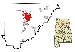
 Location in Cullman County and the state of Alabama |
|
| Location in the United States | |
| Coordinates: 34°10′39″N 86°50′41″W / 34.17750°N 86.84472°W | |
| Country | United States |
| State | Alabama |
| County | Cullman |
| Settled | 1873 |
| Incorporated | 1878 |
| Founded by | Colonel Johann Gottfried Cullmann |
| Named for | Colonel Johann Gottfried Cullmann |
| Government | |
| • Type | Mayor-Council |
| Area | |
| • Total | 20.6 sq mi (53.3 km2) |
| • Land | 19.4 sq mi (50.2 km2) |
| • Water | 1.2 sq mi (3.1 km2) |
| Elevation | 898 ft (251 m) |
| Population (2015 est.) | |
| • Total | 15,350 |
| • Density | 776/sq mi (299.5/km2) |
| Time zone | Central Standard Time (UTC-6) |
| • Summer (DST) | CDT (UTC-5) |
| ZIP code | 35055-35058 |
| Area code(s) | 256 |
| Mayor | Woody Jacobs |
| FIPS code | 01-18976 |
| GNIS feature ID | 0116948 |
| Website | www |
Cullman is a city and the county seat of Cullman County, Alabama, United States. It is located along Interstate 65, about 50 miles (80 km) north of Birmingham and about 55 miles (89 km) south of Huntsville. As of the 2010 census it had a population of 14,775, with an estimated population of 15,350 in 2015.
In the time before European settlement, the area that today includes Cullman was originally in the territory of the Cherokee Nation. The region was traversed by a trail known as the Black Warrior's Path, which led from the Tennessee River near the present location of Florence, Alabama, to a point on the Black Warrior River south of Cullman. This trail figured significantly in Cherokee history, and it featured prominently in the American Indian Wars prior to the establishment of the state of Alabama and the relocation of several American Indian tribes, including the Creek people westward along the Trail of Tears. During the Creek War in 1813, General Andrew Jackson of the U.S. Army dispatched a contingent of troops down the trail, one of which included the frontiersman Davy Crockett.
In the 1820s and the 1830s, two toll roads were built linking the Tennessee Valley to present-day Birmingham.In 1822, Abraham Stout was given a charter by the Alabama Legislature to open and turnpike a road beginning from Gandy's Cove in Morgan County to the ghost town of Baltimore on the Mulberry Fork near Colony. The road passed near present-day Vinemont through Cullman, Good Hope, and down the current Interstate 65 corridor to the Mulberry Fork. The road was later extended to Elyton (Birmingham) in 1827. It then became known as Stout's Road. Mace Thomas Payne Brindley was given a charter in 1833 to turnpike two roads, one running between Blount Springs to Somerville by way of his homestead in present-day Simcoe, and the second road passing west of Hanceville and east of Downtown Cullman to join Stout's Road north of the city. What later became the Brindley Turnpike became an extension of Stout's Road to Decatur. Cullman later became located between the juncture of the two roads, and they predated the corridor of U.S. Route 31.
...
Wikipedia

